Heritage Digitization with Leica RTC360: Millimeter-Accurate Geometry, True-to-Life Colors
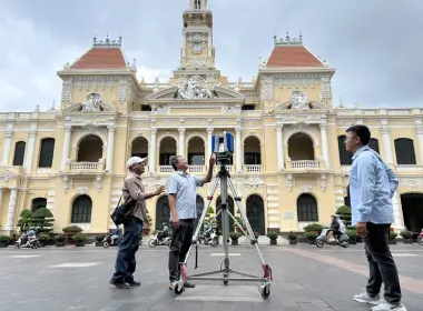
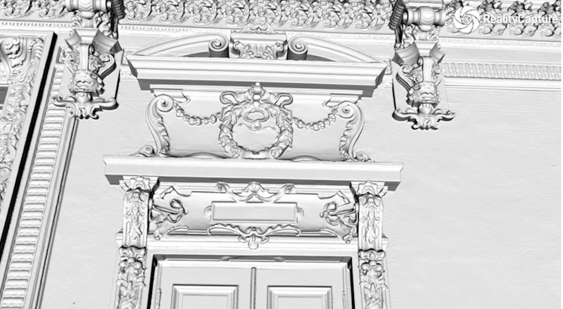
Heritage digitization is the process of recording a monument's as-found condition before any intervention takes place. 3DSCAN carries out this work using the Leica RTC360 terrestrial laser scanner combined with close-range photography (photogrammetry), producing a record with two layers: geometry accurate to the millimeter in true position and dimension — 3D point accuracy of 1.9 mm at 10 m, scan rate of 2,000,000 points per second per Leica Geosystems datasheet — and a true-color imagery layer that captures carved ornaments, Sino-Vietnamese inscriptions, lacquer-and-gold-leaf finishes, and every flake and crack on the surface. This underpins the heritage conservation survey service that 3DSCAN delivers from its headquarters in Ho Chi Minh City for monuments across Vietnam.
Get a heritage digitization consultation
1. What a Monument Needs Recorded Before Intervention
A heritage structure holds its historical value in three things: architectural form, carved detail, and the traces of time on its surfaces. A sagging roofline, a row of tilting columns, a chipped relief panel, faded red lacquer and gold leaf — all of this is information that must be captured before cleaning, dismantling, or reinforcing. Once intervention begins, most of these traces can never be measured again.
A usable restoration dossier must answer two questions at once: where each element is located and what its true dimensions are — so the designer can produce plans, elevations, sections, and quantity take-offs; and what the surface of each element currently shows — so the conservation specialist can describe the artifact's condition and identify areas requiring treatment. Only one of the two makes the dossier incomplete. The value of digitization lies in creating a record that can be verified and re-measured, not in producing a model that merely looks good.
2. Leica RTC360 — Millimeter-Accurate Geometry
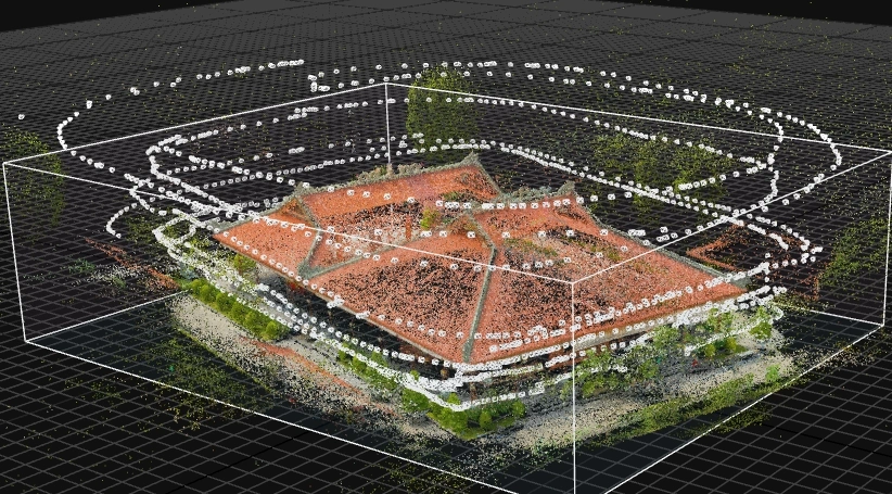
The RTC360 is a terrestrial laser scanner (TLS) that captures three-dimensional coordinates of every surface within its line of sight: floors, walls, columns, beams, roofs, and relief panels. Data from multiple stations are registered into a single seamless model in a unified coordinate system. For heritage work, the most important figure is the minimum point spacing of 3 mm at 10 m — meaning that when the scanner is set up 3–5 m from a carved panel, the point density is sufficient to reconstruct the depth and profile of the carving as measurable geometry, not just a visible image.
Leica RTC360 specifications and heritage implications
| Parameter | Published value | Heritage survey implication |
|---|---|---|
| 3D point accuracy | 1.9 mm @ 10 m · 2.9 mm @ 20 m · 5.3 mm @ 40 m | Accuracy degrades with range — basis for placing stations close to critical elements |
| Minimum point spacing | 3 mm at 10 m | Dense enough to reconstruct carved depth, moldings, and fretwork patterns |
| Scan rate | Up to 2,000,000 points per second | Minimizes time occupying worship spaces open to the public |
| HDR imaging system | 3 × 36 MP cameras · 432 MPx raw data per station | Colorizes the point cloud, balances dark zones inside shrine halls |
| Range | 0.5 – 130 m | Covers tight shrine interiors as well as courtyards, enclosure walls, and high roofs |
| Laser safety | Class 1 (IEC 60825-1:2014), 1550 nm wavelength | Eye-safe, non-contact — mandatory when worshippers are present |
| Time per station | Under 2 minutes (full-dome scan + HDR imagery) | More stations to reduce occlusion without extending the schedule |
Source: Leica RTC360 datasheet — Leica Geosystems. These are instrument specifications under manufacturer test conditions, not the accuracy of the delivered record.
Preserving the as-found condition — never "idealizing" the geometry
Heritage scan data must faithfully record what exists: walls that are not flat, columns that are not plumb, sagging rooflines, members with irregular cross-sections. This is precisely the information conservation specialists need to assess deformation and prioritize intervention. Reconstructing idealized geometry — perfectly vertical columns, perfectly square walls — destroys the most valuable information in the entire survey. 3DSCAN applies this principle throughout, from as-built 3D laser scanning all the way through to the final CAD drawings.
"With mortise-and-tenon timber joints in traditional Vietnamese temples, a 2 cm discrepancy in the model is enough for a replacement member to fail to fit during reassembly. We always place independent check points outside the registration workflow — without verification data, the scanner's 1.9 mm figure is just a catalogue spec, not the accuracy of the record."
— Phan Tien Duyen, Director, 3DSCAN
The accuracy of the delivered record depends on the survey plan, station density, the geodetic control network, and the quality of registration. A project scanned with an RTC360 but lacking independent control-point verification can still accumulate errors well beyond 1.9 mm. For this reason, every 3DSCAN acceptance package includes a quality control report stating the registration error, the deviation against check points, and the coordinate reference system used.
3. True-Color Imagery — The Surface Detail Layer
Geometry alone cannot convey color. A horizontal board inscription with faded red lacquer and gold leaf, a salt efflorescence stain on a brick base, a patch of flaking paint exposing the primer beneath — this is information only color imagery can capture. The RTC360 acquires 432 MPx of HDR imagery per station from three 36 MP cameras, enough to colorize the entire point cloud and balance bright-to-dark zones inside dimly lit shrine halls. For artifacts requiring even finer detail, 3DSCAN supplements with close-range photography (photogrammetry) using a dedicated kit: camera, lens, turntable, and diffused lighting system.
What determines whether colors are truly faithful
Color fidelity comes not from megapixel count but from lighting control. A usable photogrammetric image set must achieve simultaneously: sufficient overlap between adjacent frames, consistent sharpness across the entire frame, and diffused lighting that casts no hard shadows. In dimly lit worship spaces, this is the most challenging step — supplementary lighting must be bright enough, maintain the correct color temperature so as not to distort the hue of lacquer finishes, and must be a cool light source kept at a safe distance to avoid thermal risk to the painted surface.
Distinguishing "visible" detail from "measurable" detail
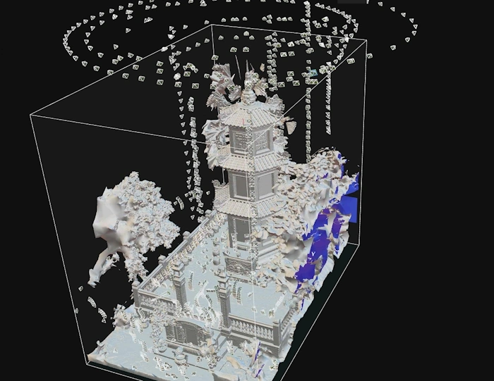
This is the most common point of confusion when reviewing a digital heritage record: a detail that is clearly visible on the texture overlay does not necessarily exist as measurable geometry in the 3D model. The image may show a 2 mm incision, but if the surface mesh resolution is insufficient, the 3D model at that location remains flat. The Terrestrial Surveying Association (TSA) guidance on close-range photogrammetry emphasizes exactly this: high image resolution does not automatically guarantee measurement accuracy. Historic England's guidance HEAG066 (Photogrammetric Applications for Cultural Heritage, 2017) adds that a photogrammetric model without survey control will exist in an arbitrary coordinate system and scale — ground control points (GCPs) are mandatory to bring it into a real-world coordinate system.
4. Combining the Two Data Layers and the Deployment Workflow
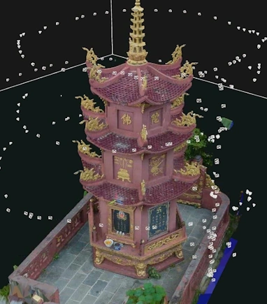
Laser scanning and photogrammetry excel at different things. The RTC360 delivers a reliable geometric framework over a wide area but is limited by a 3 mm point spacing at 10 m; photogrammetry delivers dense surface detail on individual panels but easily accumulates error when extended across an entire structure. Combined, the laser point cloud serves as the geometric reference framework, and the photogrammetric model becomes a localized detail layer registered precisely into it.
Both data layers are registered into a unified coordinate system before being assembled into the delivered digital dossier.
Consider a relief panel before restoration: the RTC360 data establish the panel's position and geometry within the overall structure; close-range photography adds surface detail at that exact location. Once both layers are registered and verified, users can delineate a flaking zone on the model, open the corresponding source photograph, extract an orthoimage to measure the damaged area, and discuss a specific zone with all parties instead of relying on verbal descriptions. 3DSCAN applies the same approach when building 3D models with UAV and laser scan for structures with high roofs that cannot be observed from ground level.
Seven steps in a heritage digitization campaign
Seven steps: preliminary survey → control network and GCPs → RTC360 laser scanning → close-range photography → registration and processing → quality control → dossier delivery.
5. Deliverables and Their Role in the Restoration Dossier
A complete heritage digitization package comprises the deliverables listed below. The specific scope depends on the intended use — not every project requires all items.
Deliverables and intended use
| Deliverable | Format | Used for |
|---|---|---|
| Registered point cloud | E57, LAS/LAZ, RCP/RCS, PTS | Direct measurement, drawing production, archival storage |
| Colored surface mesh | OBJ, FBX, glTF | Carved detail study, digital exhibition |
| Orthoimages | GeoTIFF, scaled JPG | Condition mapping, damage area measurement |
| As-found drawings | DWG/DXF, PDF | Restoration design, appraisal, acceptance |
| VR360 and Web Viewer | 360° imagery, 3D Tiles | Remote condition review, multi-party collaboration |
| Quality control report | Acceptance basis, documented error and coordinate system |
From the verified dataset, the technical team extracts plans, elevations, sections, and orthoimages as required by the design dossier; for structures with complex framing systems, the data feed into a Scan to BIM workflow to model individual members for quantity take-off. Orthoimages and geometric models together become the base for conservation specialists to delineate zones of flaking, cracking, detail loss, salt efflorescence, and discoloration — each annotation pinned to a position on the model, with a reference photograph and the date of observation. Across all deliverables, measured areas must be clearly distinguished from areas with no data coverage or from hypothetical reconstructions.
When successive surveys share a stable reference framework, the data also enable monitoring of change over time — column tilt, beam deflection. Any difference must be evaluated against the measurement uncertainty of each survey epoch: a 3 mm difference between two epochs with ±5 mm uncertainty does not constitute evidence of actual deformation.
6. Conclusion
Heritage digitization delivers value only when the record captures both millimeter-accurate geometry and the true colors and surface detail of the artifact. The Leica RTC360 provides the first layer; true-color close-range photogrammetry provides the second. The determining factor is not instrument specifications but the survey plan, the control network, the quality control workflow, and the clear distinction between measured data and inferred reconstruction.
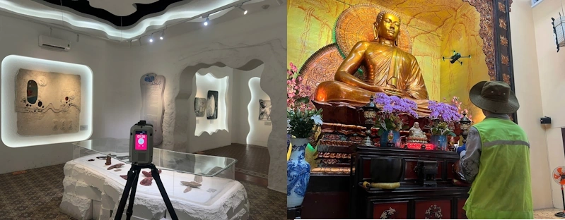
3DSCAN owns a Leica RTC360 along with GNSS, total station, UAV, and close-range artifact photography equipment, and maintains dedicated survey and data processing teams. The company is headquartered in Ho Chi Minh City and has delivered heritage conservation projects across multiple provinces, including 3D laser scanning of Xa Loi Pagoda and laser scanning of Hanoi St. Joseph's Cathedral.
Related 3DSCAN projects
- 3D Laser Scanning for Xa Loi Pagoda Conservation — laser scanning combined with UAV and detail photography for a religious landmark in Ho Chi Minh City.
- 3D Modeling for An Khanh Temple Conservation — survey and 3D modeling of a traditional timber-framed shrine.
- Laser Scanning of Hanoi St. Joseph's Cathedral — as-built data capture for a large-scale architectural heritage monument.
- Heritage Conservation Survey Service — workflow, deliverables, and deployment scope.
Is your heritage site preparing a restoration dossier or in need of as-found documentation before intervention? Send 3DSCAN the site scope and the list of elements requiring conservation — we will discuss a Leica RTC360 scanning and close-range photography plan, deliverables, and acceptance criteria tailored to your project.
Contact 3DSCAN Hotline: 0938 309 808 · Email: lienhe@3dscan.vn