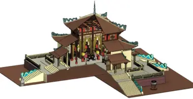
3D Topographic Survey Services with UAV
3DScan.vn provides 3D topographic survey services with UAVs that are not only faster and more accurate, but also deliver vivid, intuitive data with multi-sector applications. With just a single flight, clients can use the data throughout the entire project lifecycle: from survey and design to construction, management, and promotion. This modern solution helps cut costs, shorten schedules, and improve investment efficiency for every project.
Contact us now at 0938.309.808 to get a detailed quotation and fast turnaround.
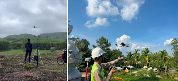
Overview of 3D Topographic Survey Services with UAV
UAV technology and modern processing software
RTK/PPK UAVs (Real-Time Kinematic / Post-Processed Kinematic) are equipped with high-precision GNSS, enabling topographic data collection with errors of only a few centimeters when combined with ground GNSS stations.
- UAVs capture large-area imagery in a short time, covering from a few hectares to hundreds of hectares per day.
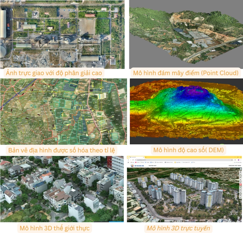
- Image data is processed with specialized software such as Agisoft Metashape, Pix4D, ContextCapture, generating:
- High-resolution orthophotos.
- Digital Terrain Models (DTM) and Digital Surface Models (DSM).
- 2D/3D topographic maps with contour lines, elevations, hydrography, and existing structures.
This technology ensures that clients receive topographic data that is detailed – visual – accurate, suitable for design, construction, earthworks, and land management.
Why UAVs are revolutionizing topographic surveying
Previously, topographic surveys relied mainly on manual measurements or total stations, which required a lot of time and manpower and involved risks in difficult terrain. With UAVs, the workflow has been completely transformed:
- Fast: a single flight can survey 100–200 ha per day.
- Safe: no need to send personnel into hazardous areas (mountains, rivers, quarries).
- Accurate: errors of only a few centimeters when combining GNSS and GCPs.
- Complete & visual: in addition to elevation data, you also get orthophotos, 3D models, and data that easily integrates with CAD/GIS/BIM.
UAVs help investors, contractors, and consultants shorten survey time by 30–50%, save costs, and obtain transparent, verifiable data.
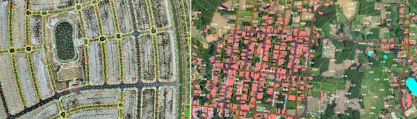
Benefits of using UAV for 3D topographic surveys
- High accuracy: ensures stable data that truthfully reflects the shape and dimensions of the surveyed area.
- Rapid data collection: significantly reduces field time compared to manual measurements.
- Cost savings: a single flight provides comprehensive data, reducing labor and accelerating progress.
- Safety: accesses hazardous areas without sending people into them.
- Comprehensive datasets: orthophotos, point clouds, DSM/DTM, 3D models, and 2D/3D maps.
- Software compatibility: easy to import into CAD, GIS, and BIM for design and management workflows.
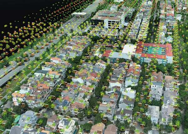
3DScan.vn’s 3D UAV Topographic Survey Workflow
A standardized workflow from initial assessment and flight planning to data acquisition, processing, and delivery – optimized for speed, accuracy, and real-world applicability.
- Step 1: Project intake & analysis: define objectives (topographic mapping, volume calculation, design), area, and required level of detail.
- Step 2: Flight planning: design RTK UAV flight paths, altitude, image overlap, and set up GCPs (ensuring centimeter-level accuracy).
- Step 3: Flight & data acquisition: use RTK UAVs (Mavic 3E RTK, Phantom 4 RTK) with Base/CORS stations for coordinate correction.
- Step 4: Data processing: use Pix4D, Metashape, RealityCapture to generate orthophotos, DEM/DTM, point clouds, and 3D meshes; validate GCPs with errors < 3 cm.
- Step 5: Deliverables: topographic maps (DWG, DXF, SHP, GeoTIFF), detailed survey reports, and visual 3D models.
Typical execution time: 2–7 days, depending on location, area, and required level of detail.
Comparison: 3D UAV Topographic Survey vs Traditional 2D Topographic Mapping
| Criteria | Traditional 2D survey | 3D survey with UAV |
|---|---|---|
| Method | Manual measurement with total station, handheld GPS, leveling, etc. | RTK/PPK UAV flights with 3D processing |
| Time | Many days for large areas | A few hours to 1–2 days for hundreds of hectares |
| Accuracy | Depends on manpower; prone to local errors | Centimeter–millimeter level when combining RTK and GCPs |
| Level of detail | Elevations/contours and limited information | Point clouds, orthophotos, DEM/DTM, 3D models |
| Visualization | Hard to visualize (2D) | Lifelike 3D, easy to understand |
| Safety | Requires direct field access, including hazardous areas | Aerial survey, reduced risk |
| Applications | Basic 2D maps, preliminary design | Design, planning, BIM, volume calculation, monitoring, promotion |
| Overall cost | High due to large labor/time requirements | Optimized thanks to short survey time and multi-purpose data |
| Reusability | Limited | Usable throughout the project lifecycle |
Conclusion: 3D topographic surveys using UAVs are superior in terms of speed, detail, visualization, and breadth of application.
Practical applications of 3D UAV topographic surveys
- GIS data acquisition: accurate spatial data foundation.
- Infrastructure BIM development: integrating 3D models into BIM.
- Construction progress monitoring: comparing 3D models over time.
- Asset & infrastructure management: digitizing current conditions for operations.
- Transparent land boundary management: determining boundaries and reducing disputes.
- Current land use maps: supporting management and planning.
- Construction & infrastructure: topographic surveys and earthwork volume calculations.
- Urban and rural planning: intuitive 3D topographic maps.
- Mining & industry: measuring mine reserves and stockpiles.
Featured projects by 3DScan.vn
- 1/2000 topographic survey of Sapung Urban Area, Bao Loc City – ~6000 ha for urban planning (Hung Thinh Group).
- 1/500 topographic survey of MerryLand Tourism Area, Hai Giang, Binh Dinh ~120 ha for golf course planning (Hung Thinh Group).
- 1/500 topographic survey of Le Minh Xuan Residential Area for earthworks, Ho Chi Minh City (Khang Dien Group).
- 1/500 topographic survey of Dormitory of Vietnam National University HCMC, Zones A & B for detailed planning (Dormitory Project Management Board).
- 3D GIS mapping for urban management in Wards 1 & 2, Dong Xoai City, Binh Phuoc.
- … and many other projects.
Frequently Asked Questions (FAQ)
How much area can a UAV survey per day?
How does the accuracy compare to traditional surveying?
Can dense forests be surveyed?
In what formats is the data delivered?
Can the data be used for BIM and GIS?
Can we view the 3D model online?
What if there is water surface or dense vegetation?
How is accuracy controlled?
Do UAV flights require permits?
What factors influence survey cost?
What is the legal validity of UAV topographic maps?
Contact for 3D UAV Topographic Survey Quotation
Do you need fast, accurate topographic surveys and 3D models? Contact 3DScan.vn for an optimized solution tailored to your needs.
3DSCAN Technology Company Limited
Tax code: 0318974406
Address: 730/30 Huynh Tan Phat Street, Tan Phu Ward, District 7, Ho Chi Minh City
Phone: 0938.309.808
Email: lienhe@3dscan.vn
Website: 3dscan.vn
```