3D Modeling Services with UAV & Laser Scan
3DScan.vn provides 3D modeling services with UAV & Laser Scan, delivering highly detailed data with millimeter-level accuracy, clear visualization, fast turnaround, and high safety. Survey once and reuse the data throughout the entire lifecycle of the asset: design, planning, construction, operation management, and long-term preservation of its value.
Contact 0938 309 808 for a detailed quotation & fast execution time
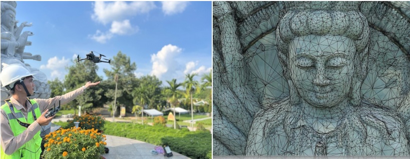
Overview of 3D Modeling Services with UAV & Laser Scan
Terrestrial Laser Scanning (TLS)
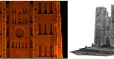
Millimeter-level accuracy, ideal for modeling small details such as statues, architectural ornaments, interiors, or complex structures. The scanner captures millions of points per second, faithfully reproducing surface geometry and color.
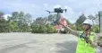
RTK/PPK UAV
Covers areas from a few hectares to thousands of hectares in a short time, with accuracy down to a few centimeters. Aerial imagery is processed in Agisoft Metashape, Pix4D, ContextCapture to produce orthophotos, DEM/DTM, and overall 3D meshes/models.
Combining UAV & Laser Scan
- Millimeter-level detail for artifacts, architecture, and interiors.
- Centimeter-level accuracy for buildings, infrastructure, and large landscapes.
- Merged into a unified 3D model that is easy to share and leverage.
Why UAV & Laser Scan are a Breakthrough
From traditional to modern
Previously: manual measurements or traditional aerial photos — slow, costly, and fragmented data. Today: UAVs rapidly capture large areas; Laser Scan delivers ultra-high detail down to each ornament.
The combination creates multi-level, comprehensive 3D models — from incense burners just a few dozen centimeters tall to urban areas spanning several hundred hectares.
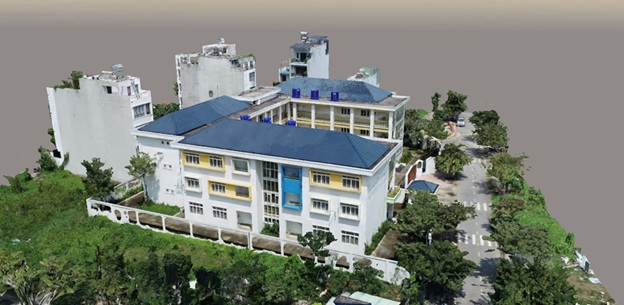
Benefits of Using UAV for 3D Modeling
- 3D data detailed to each centimeter for a clear understanding of current conditions.
- Accurate earthwork volume calculation for cost estimation.
- Transparent land boundary definition to reduce disputes.
- Support for design & planning, easy integration with CAD/BIM.
- Progress monitoring by comparing 3D models across project phases.
- Asset & infrastructure management with Digital Twin.
- Time & cost savings in surveying compared to traditional methods.
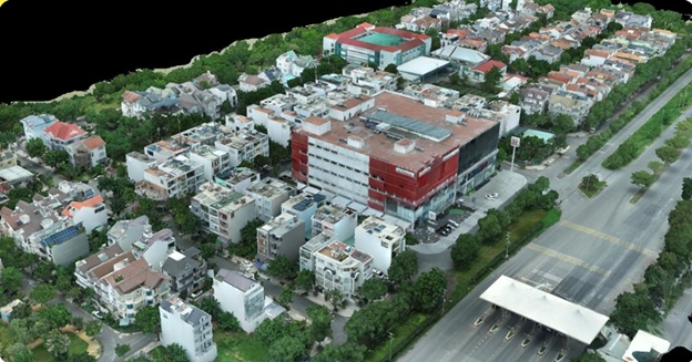
3D Modeling Workflow with UAV at 3DScan.vn
From survey to handover
- Step 1 – Intake & consulting: define objectives, scope, and technical standards.
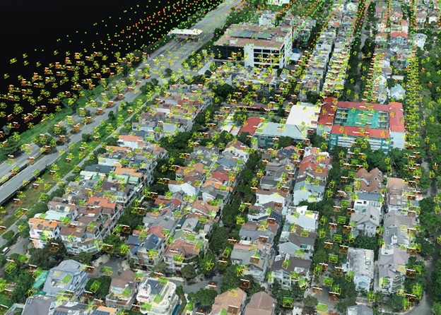
- Step 2 – Flight planning: RTK UAV flight paths, altitude, overlap, and layout of GCP/BASE/CORS.
- Step 3 – Data acquisition: RTK UAV captures high-resolution imagery covering the entire area.
- Step 4 – Processing & modeling: Metashape/Pix4D/ContextCapture generate orthophotos, DEM/DTM, point clouds, and 3D meshes; GCP validation with errors < 3 cm.
- Step 5 – Handover: 2D (DWG, DXF, GeoTIFF), 3D (OBJ, FBX, E57), reports, and online viewer.
Typical turnaround: 2–7 days depending on location, area, and level of detail.
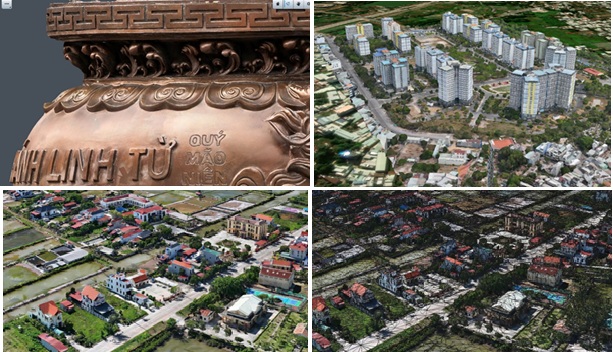
Levels of 3D Models with UAV
Detail level (small artifacts)
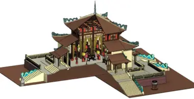
Incense burners, stone statues, triple-arched gates, etc. Low-altitude flights with ultra-high-resolution imagery produce crisp models down to each ornament.
Single-building level
Houses, factories, bell towers, bridges, etc. Accurately represents structure, materials, and colors, supporting design and preservation.
Complex / heritage / resort level
Pagodas/temples, schools, factories, small urban areas… Higher-altitude flights with broad coverage create overall models of landscape and infrastructure.
Large-area level (hundreds–thousands of hectares)
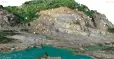
Mines, industrial parks, urban planning areas… RTK/PPK UAV fly large-area grids to generate DEM/DTM, orthophotos, and detailed 3D terrain models for planning and resource management.
Practical Applications of UAV 3D Models
- Construction & infrastructure: topographic surveys, progress monitoring, and as-built BIM checks.
- Planning & urban development: detailed 3D maps for smart city initiatives.
- Agriculture & forestry: crop monitoring, vegetation assessment, and forest management.
- Mining & industry: mine/stockpile volume calculation, exploitation monitoring, and yard management.
- Heritage conservation: detailed digitization of monuments for research, archiving, and restoration.
- Real estate & tourism: project promotion using 3D models and visual videos.
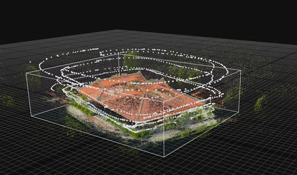
Featured Projects by 3DScan.vn
- Tan Hue Vien Tourist Area, Vinh Long — 20 ha/day, ~50% cost optimization.
- Pandanus Resort, Binh Thuan — 20 ha/day, ~50% cost optimization.
- Dormitory of Vietnam National University HCMC — 40 ha/2 days, ~50% cost optimization.
- Incense burner & temple gate — An Khanh Temple (high-detail modeling).
- My Son Sanctuary complex (overall 3D model).
- … and many other projects.
Frequently Asked Questions
How many hectares can a UAV survey per day?
Depending on UAV type and conditions, RTK UAVs can cover 100–200 ha/day with high accuracy.
How accurate is it compared to manual surveying?
When combining RTK/PPK and GCPs, errors are only a few centimeters down to millimeters, equivalent to or better than traditional methods.
Can densely vegetated areas be surveyed?
Yes. Photogrammetry UAVs capture surface features; to obtain terrain beneath the canopy, UAV LiDAR with foliage penetration capability is required.
Can the 3D model be viewed online?
Yes. 3DScan.vn supports an online 3D viewer available 24/7 for remote project sharing and management.
In what formats is the data delivered?
Common formats include: OBJ, FBX, DWG, DXF, GeoTIFF, E57; ready for integration with CAD/BIM/GIS and accompanied by an online viewer.
Contact for Quotation – 3D Modeling Services with UAV & Laser Scan
Need fast & accurate as-built surveys and 3D modeling? Contact 3DScan.vn for an optimized solution tailored to your project.
3DSCAN Technology Company Limited
Tax code: 0318974406
Address: 730/30 Huynh Tan Phat Street, Tan Phu Ward, District 7, Ho Chi Minh City
Phone: 0938 309 808
Email: lienhe@3dscan.vn
Website: 3dscan.vn
```