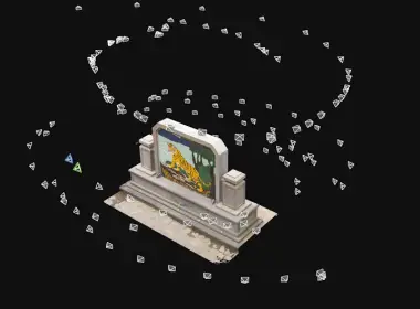
Existing Condition Survey for Design & Renovation Using UAV and Z+F 5016 Laser Scanning (Accuracy < 3 mm)
3DSCAN provides specialized existing-condition survey services for design, renovation, repair, and conservation projects by integrating UAV RTK (aerial survey) and the Z+F 5016 Laser Scanner (terrestrial laser scanning with millimeter-level detail). This standardized workflow captures the complete 3D geometry of the building and fine details of aged architectural elements, supporting 3D/BIM modeling, technical drawing extraction, and legal documentation ready for design use.
Contact 3DSCAN for an existing-condition survey
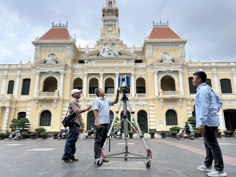
Existing-condition laser scanning using Z+F Imager 5016
1) Service Objectives & Scope
- Comprehensive digital capture of existing conditions with < 3 mm accuracy for architecture, structure, interiors, and landscape.
- Detailed recording of historic elements (ornaments, moldings, statues, decorative features, original objects) for conservation and restoration.
- Preparation of as-built drawings (plans, elevations, sections, details) and 3D/BIM models ready for design development.
- Transparent legal documentation: technical report, photo log, coordinate/elevation tables, and handover records.
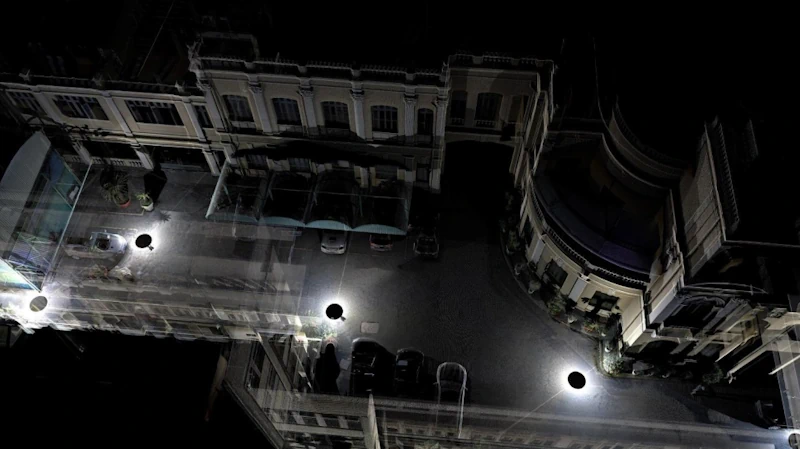
Laser scan station positions after processing
2) Typical Applications
This service is suitable for civil and industrial buildings, government offices, religious and heritage sites, architectural landmarks, hotels, factories, commercial centers, schools, hospitals, urban developments, and technical infrastructure projects.
- Design & renovation: obtain reliable as-built data and avoid discrepancies between outdated drawings and actual conditions.
- Conservation & restoration: digitally preserve detailed existing conditions and reduce the risk of losing original heritage value.
- Inspection & legal documentation: objective, transparent datasets that are easy to verify and cross-check.
- Facility management: clear 3D data for better maintenance, repair, and upgrade planning.
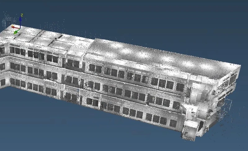
Existing-condition building point cloud
3) Equipment & Technology
3.1. Z+F 5016 Laser Scanner (TLS)
- Measurement accuracy < 3 mm (10–30 m); speed > 1 million points per second.
- Scanning range 360° horizontal, 320° vertical; HDR camera for realistic colored point clouds.
- Suitable for operation in tight spaces, cluttered environments, and complex lighting conditions.
3.2. UAV RTK (High-Accuracy Aerial Survey)
- Roof scanning, high façades, and surrounding landscape; RTK ensures absolute coordinate accuracy.
- Orthomosaic, DSM/DTM integrated with TLS to complete the overall model.
3.3. Processing & Modeling Software
- Z+F LaserControl, CloudCompare, ReCap/RealWorks/Scene for point cloud processing.
- AutoCAD, Revit, ArchiCAD for 2D/3D/BIM; export formats include DWG, IFC, RVT, E57, RCP.
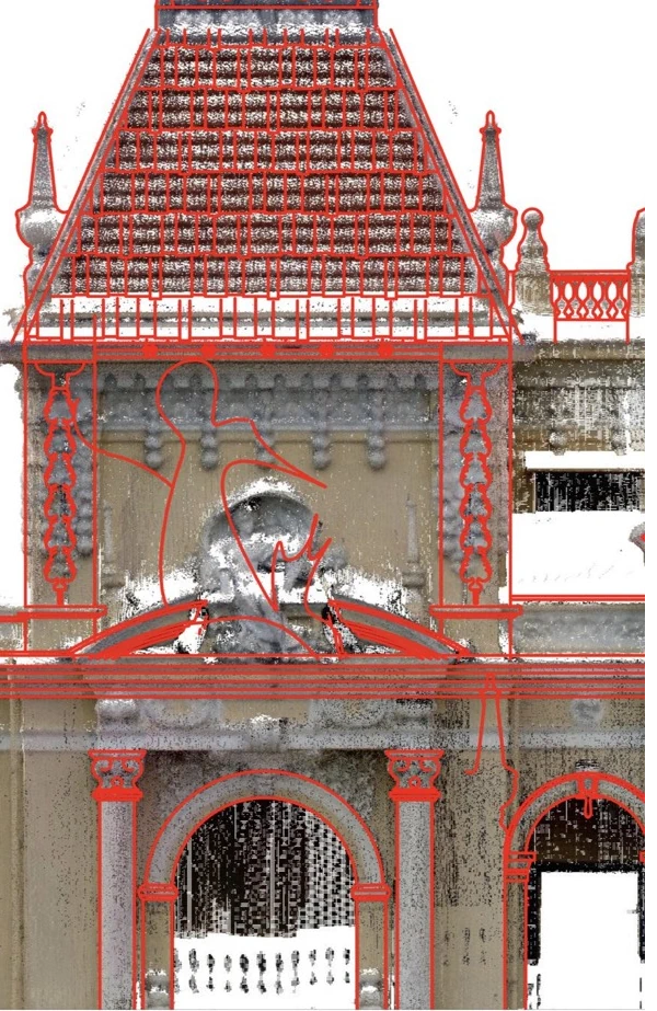
Comparison between older digitized drawings and newly scanned point cloud (revealing discrepancies)
4) Standardized Workflow
- Project intake & planning: define scope, technical objectives, level of detail, and deliverable standards; prepare risk matrix and safety measures.
- Control points & coordinate system setup: VN-2000 and Hon Dau elevation system; equipment checks, calibration, and workflow testing.
- UAV survey: flight planning, GCP setup (if required), image acquisition for orthomosaic and DSM/DTM, scanning roofs and hard-to-reach façades.
- TLS scanning: place Z+F 5016 scan stations to fully cover exterior and interior spaces; apply a line-of-sight strategy to reduce blind spots; add detailed scans for heritage elements.
- Registration & adjustment: cloud-to-cloud / target-based registration; maintain internal registration error < 2 mm; align with UAV and control points.
- Cleaning & classification: remove noise; classify data by space, material, and function; assign attributes to heritage objects.
- 2D/3D extraction: generate plans, elevations, sections, details; develop BIM models at the required LOD.
- QA/QC & acceptance: cross-check errors; perform spot verification on site; prepare technical report and legal documentation.
- Handover & digital archiving: transfer datasets, provide user guidance, support long-term storage and version updates.
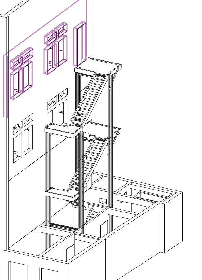
3D building model for digital documentation
5) Accuracy & Quality Control
- End-to-end measurement accuracy: target < 3 mm for detailed elements, < 2 mm for internal registration error, with a unified absolute coordinate system.
- Cross-validation between TLS, UAV, and on-site verification; sample checks at representative locations.
- Standardization of layers, symbols, colors, and scale, ready for integration into BIM/GIS workflows.
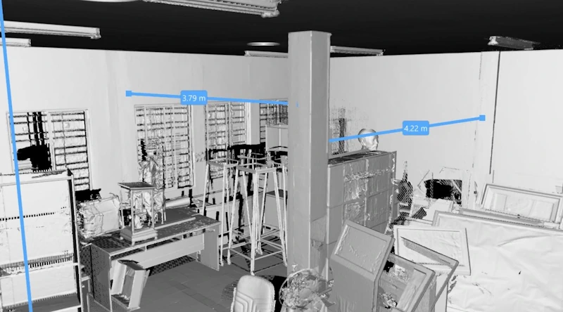
Accuracy check between real conditions and point cloud results
6) Deliverables
Point Cloud & Imagery
- E57/RCP/LAS with HDR color
- Orthomosaic, DSM/DTM
- Field photo log
As-Built Drawings
- Plans, sections, elevations
- Details of heritage elements and components
- Dimension and elevation schedules
3D / BIM Model
- RVT / IFC, LOD as required
- Architecture – Structure – MEP layering
- Embedded metadata for heritage objects
Reports & Legal Documentation
- Technical report & QA/QC documentation
- Coordinate/elevation tables and reference system
- Acceptance and handover records
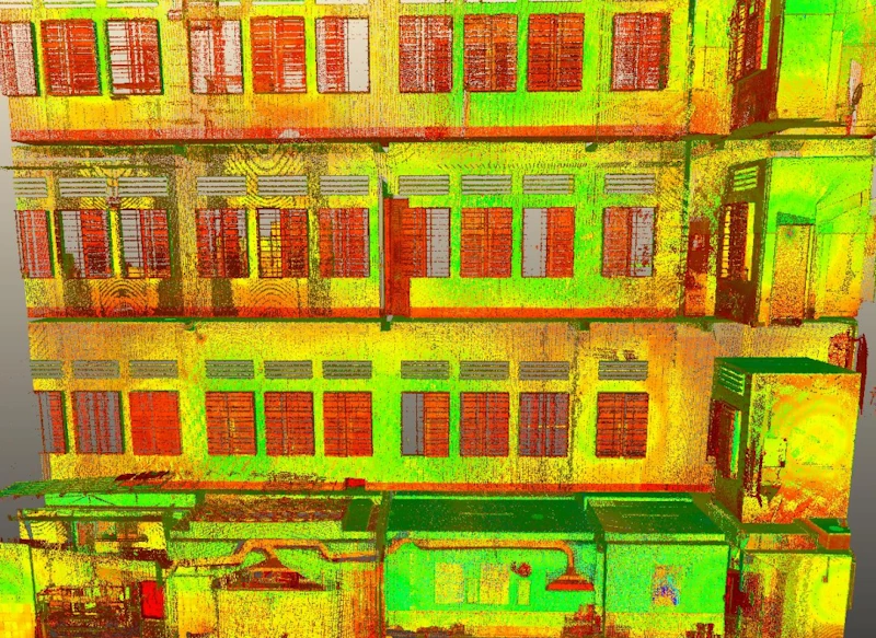
Building façade point cloud
7) Detailed Recording of Historic Elements
With dense point cloud coverage and < 3 mm accuracy, the Z+F 5016 enables extraction of fine ornaments, moldings, reliefs, statues, woodwork, and stone details with high clarity. 3DSCAN establishes coding conventions, oblique photography, and local sections to ensure the dataset is sufficient for conservation analysis and future restoration in case of damage.
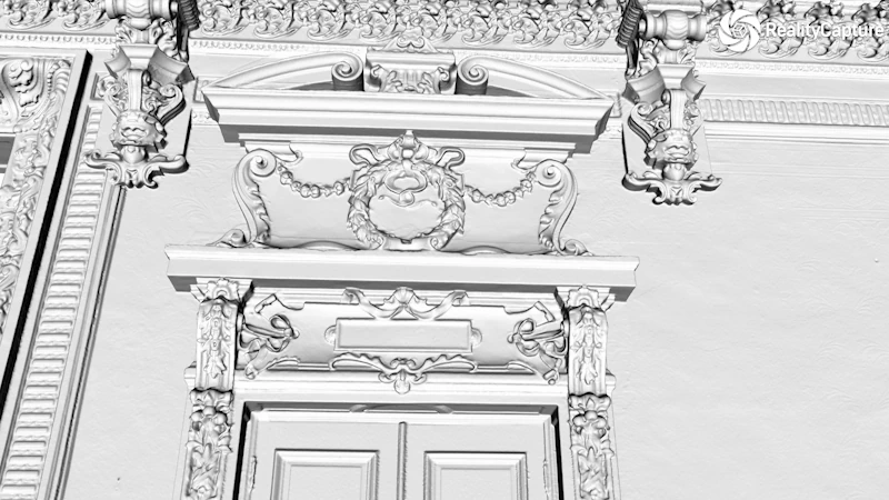
French-period ornament scanned in high detail
8) Key Benefits for Stakeholders
- Owners: objective data basis, reduced legal risk, optimized design-change costs.
- Design consultants: standardized 2D/3D/BIM datasets that save survey and correction time.
- Contractors: coordinated models that reduce on-site clashes.
- Authorities: transparent documentation that is easy to review and archive long-term.
9) Why Choose 3DSCAN
- Integrated UAV + TLS workflow: full coverage from roofs and façades to interiors and architectural details.
- Accuracy < 3 mm: suitable for demanding renovation, conservation, and inspection projects.
- Clear SOP-based workflow, multi-layer QA/QC, and multi-format deliverables.
- Expert team in surveying, architecture, BIM, and conservation, with experience in heritage and complex projects.
- Secure data management & archiving: safe handling with support for version updates throughout the project lifecycle.
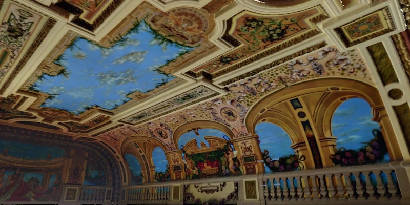
Colored French-period ornament after 3D modeling from laser scan data
10) Frequently Asked Questions (FAQ)
How long does implementation take?
Depending on project scale: typically 1–3 days for field survey and 3–10 days for processing, modeling, and drawing preparation. A detailed schedule will be proposed by 3DSCAN in the project plan.
For which items does the < 3 mm accuracy apply?
It applies to TLS scanning within an appropriate range (10–30 m) and to detailed elements. For roofs and distant façades, UAV data is aligned with TLS to ensure overall dataset reliability.
Do you provide BIM models?
Yes. 3DSCAN delivers RVT/IFC models at the required LOD, organized by architecture, structure, and MEP, with optional material and heritage-object attributes.
11) Contact
3DSCAN.vn – Existing-condition survey & 3D/BIM modeling using UAV and Laser Scanning.
📞 0938309808 | ✉️ lienhe@3dscan.vn | 🌐 https://3dscan.vn/lien-he