Heritage Conservation Survey Services
3DScan.vn’s comprehensive digital heritage solution: accurate – safe – non-invasive. We combine Laser Scan (mm-level) and RTK/PPK UAV (cm-level) to create multi-layer 3D models, ready for research, restoration, and digital exhibition.
Get a quotation within 24h • View 3D demo • Call 0938 309 808
*Typical implementation time: 2–7 days, depending on scale, field conditions, and required level of detail.
Overview
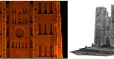
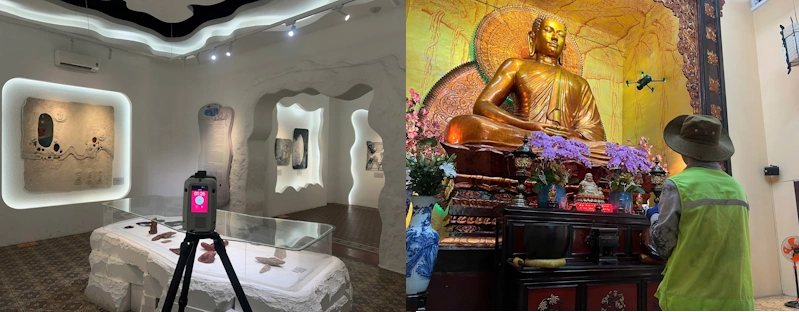
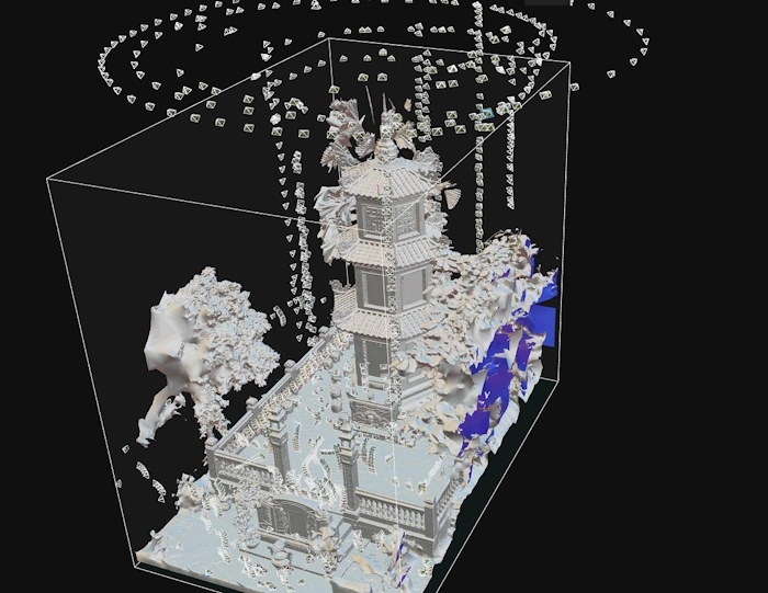
3DScan.vn uses Terrestrial Laser Scanners (TLS) to capture very high point density at millimeter level for statues, reliefs, interiors, etc., and RTK/PPK UAVs to cover large areas with centimeter-level accuracy. Close-range imagery is color-calibrated to preserve tones, weathering marks, and material texture. Data is registered and merged into point clouds and textured 3D models, along with orthophotos and DEM/DTM, ready for CAD/GIS integration and online viewing (Cesium/Potree).

Key Benefits of Working with 3DScan.vn
- Non-invasive – artifact-safe: minimal surface contact and safe movement paths.
- Extremely high detail: mm for details; cm for overall landscape and infrastructure.
- True-to-life color: color calibration workflow, controlled lighting and shadow.
- Online viewer: share 3D models via web with access control and watermarking.
- Time & cost efficiency: streamlined, automated workflow with 2–7 day deployment.
Technical Solution: Laser Scan × UAV
Terrestrial Laser Scanning (TLS)
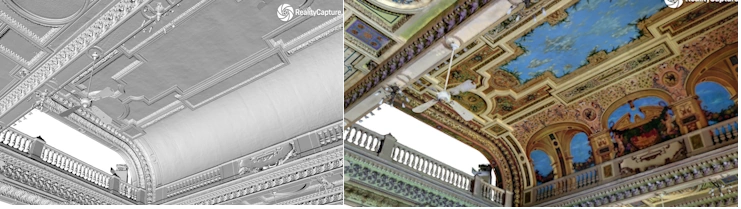
Very high point density, millimeter accuracy for statues, reliefs, interiors; occlusions handled via multiple scan stations and targets.
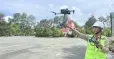
Photogrammetric/RTK/PPK UAV
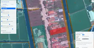
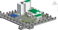
Overall coverage at cm-level; nadir + oblique imagery to capture architectural details; generates orthophotos, DEM/DTM, and overall 3D meshes.
Processing & Integration
Point cloud registration and merging; 3D mesh generation with color-calibrated texture; data layering; alignment to national/regional coordinate systems.
Implementation Workflow
- Intake & preliminary survey: conservation objectives, key areas, legal and safety requirements.
- Survey planning: equipment (RTC360/P50, RTK/PPK UAV), scan routes, GCP/targets, weather windows.
- Data acquisition: static scanning + aerial imaging (nadir/oblique); control of occlusions and reflections.
- Processing & modeling: point cloud registration and merging, 3D mesh and texture generation, orthophotos, DEM/DTM.
- Deformation analysis (optional package): tilt, displacement, cracking; slope and drainage maps.
- Validation & handover: error reports, data checklist, and secure online viewer.
Deliverables
- Point cloud: E57/LAZ, segmented by area/volume, with metadata.
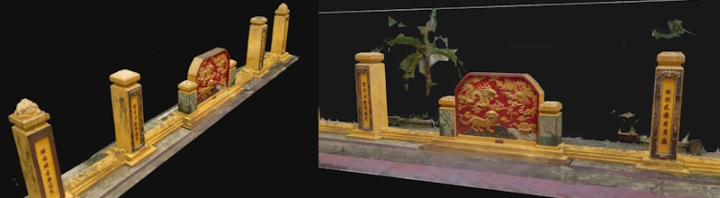
- 3D mesh + texture: OBJ/FBX/GLB; optimized UV; color-calibrated textures.
- Orthophotos & terrain: orthophotos and DEM/DTM (GeoTIFF).
- 2D drawings: plans, elevations, sections (DWG/PDF) extracted from the model.
- Online viewer: Cesium/Potree links (24/7), access control, watermarks.
- Technical report: equipment, processing parameters, errors, conservation recommendations.
Standard deliverable checklist: point cloud + 3D mesh + orthophoto/DEM + report + viewer; additional 2D drawings as per package.
Advanced Applications
- Deformation assessment: multi-temporal comparison; tilt, settlement, and crack mapping.
- Digitization of sculptures/ornaments: high-density point clouds for material and technique studies.
- Digital restoration: as-is reconstruction, hypothesized missing components, and 3D printing preparation.
- Risk management: as-built records supporting restoration, fire safety, and disaster response.
- Exhibition & education: web/AR/VR models and virtual tour videos.
Quality & Legal Standards
- Accuracy: mm (detailed Laser Scan), cm (RTK UAV/GCP overall) per project objectives.
- Monument safety: non-invasive; vibration control; clearly defined no-touch zones.
- Color workflow: color charts and lighting control to ensure realistic textures.
- UAV legal compliance: adherence to restricted zones; permit applications when needed; safe flight planning.
- Data security: access control, encryption, and watermarking as requested by the heritage authority.
Representative Projects
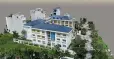
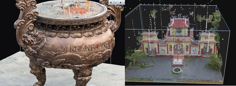
An Khanh Temple – Ho Chi Minh City
- Scope: incense burners, gates, architectural ornaments.
- Results: mm-level point clouds + 3D mesh/texture; online viewer for the evaluation council.
My Son Sanctuary – Quang Nam
- Scope: brick towers, foundations, and landscape.
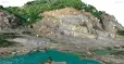
- Results: orthophotos + DEM/DTM + overall 3D model for research.
*Scope and technical specifications are adjusted according to the requirements of each heritage site.
Frequently Asked Questions (FAQ)
How long do heritage survey projects usually take?
Typically 2–7 days for surveying and basic processing. Deformation analysis or digital restoration packages require additional time depending on scale and level of detail.
What level of measurement accuracy can be achieved?
Laser Scan achieves millimeter accuracy in detailed areas; RTK UAV delivers centimeter accuracy at overall scale when GCPs are used and field conditions are suitable.
Does the workflow affect the heritage site?
The workflow is non-invasive, minimizes direct contact with artifacts, and controls no-touch and vibration zones, ensuring safety for both people and the monument.
Do you support digital display/exhibitions?
Yes. We provide web viewers, GLB models for AR/VR, fly-through videos, and guidelines for digital exhibitions as needed.
In what formats is the data delivered?
Point clouds (E57/LAZ), 3D meshes (OBJ/FBX/GLB), orthophotos/DEM (GeoTIFF), 2D drawings (DWG/PDF), and links to online viewers.
Quotation & Contact
Please share your objectives, project scale, required level of detail (mm/cm), and legal/time constraints. We will propose an optimized solution and send a quotation within 24 hours.
Contact 3DScan.vn now for consultation and to receive an optimal stock management solution using 3D scanning technology.
Hotline: 0938.309.808
Email: lienhe@3dscan.vn
Website: www.3dscan.vn