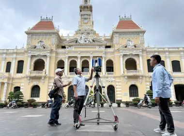
Digitising A Heritage Site Before Relocation: 3D Laser Scanning At Tinh Xa Temple And Pagoda (Bac Ninh)
Tinh Xa communal temple (Luong Tai commune, Bac Ninh) is a nationally ranked historical and cultural heritage site, first built in the Le Trung Hung period. Its load-bearing frame is ironwood joined by traditional mortise and tenon — every member a one-off, carved by hand, with no duplicate anywhere. The temple and its neighbouring pagoda fall inside the master plan for Gia Binh International Airport and must be relocated. Once that frame comes down, anything not already recorded is gone for good. 3DSCAN carried out a complete heritage digitisation programme using Leica RTC360 3D laser scanning, UAV photogrammetry, 360° VR capture and artefact cataloguing — producing a digital twin accurate to the millimetre, with colour as the eye sees it, and enough evidence to dismantle, number and rebuild the structure faithfully.
Talk to us about heritage digitisation
1. Tinh Xa — what has to survive the move
Tinh Xa temple is dedicated to Linh Lang Dai Vuong and was ranked a national heritage site under Decision No. 15/2003/QD-BVHTT. It follows a T-shaped (chữ Đinh) plan: a five-bay main hall in the "binh dau bit doc" style opening onto a three-bay rear sanctuary, the whole frame in ironwood. Tinh Xa pagoda stands beside it, rebuilt in 1992 on its original footing, comprising the Tam Bao hall and the Mother Goddess house.
What gives the site its value is not its size but everything that resists copying: nine royal ordination decrees on poonah paper, two stone steles from the Le and Nguyen dynasties, horizontal lacquered boards, parallel sentences, ceremonial thrones, bronze incense burners and openwork carved screens. The pagoda holds a set of gilded wooden statues — the Three Buddhas of the Three Times, Amitabha, Cundi Avalokitesvara, the Jade Emperor, the Shakyamuni Nine Dragons ensemble — together with clay statues of the Encourager of Good and the Punisher of Evil, the most fragile material of all in transit.
Hardest of all to keep are the things no drawing captures: the lean of each column, the sag accumulated in beams over centuries, the real gaps between joints, the arrangement of ritual objects along the axis leading to the sanctuary — the fingerprint of the building. Only 3D scanning records those traces in full, which is exactly the as-built documentation required before dismantling under Decision 2026/QD-TTg on Vietnam's cultural heritage digitisation programme.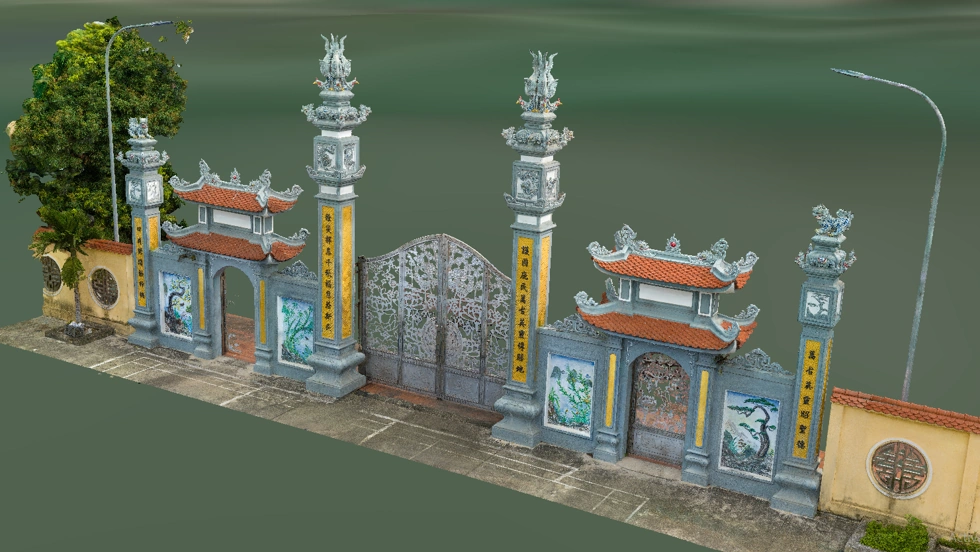
3D model image of the main gate of the Đình (communal house)
2. Four data layers, four different kinds of output quality
The survey covered 10,350 m², the full grounds of both temple and pagoda. 3DSCAN did not rely on a single technology: each instrument covers the domain it handles best, and the layers are then merged into one seamless model.
a. Leica RTC360 — carving detail readable down to the millimetre
This was the project's primary instrument. The Leica RTC360 captures 2,000,000 points per second with a 3D point accuracy of 1.9 mm at 10 m. What does that mean in the finished product? A restoration engineer can measure column cross-sections, mortise and tenon dimensions, the projection of upturned eaves and bay spacing directly off the model — at any time, at any position, with no need to return to a site that no longer exists. Openwork carving on the screens, wood grain, cracks and insect damage all stand out in the point cloud.
The scanner also carries three 36 MP cameras shooting HDR across five exposure levels, assigning true colour to every measured point. The point cloud is therefore no lifeless grey mass: gilded lacquer, the dark tone of ironwood and moss on the roof ridges are all legible for condition assessment. And the RTC360's laser is Class 1, eye-safe — a hard requirement when working in an active place of worship with people moving through it. 3DSCAN uses the same instrument for as-built architectural 3D laser scanning across Vietnam.
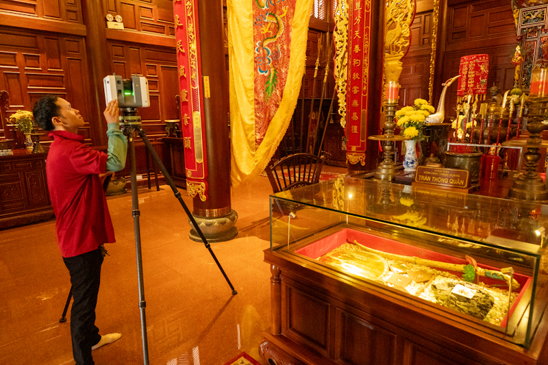
Measurements taken with the Leica RTC360
b. Mavic 3E UAV — the roof nobody can reach
From the ground, a laser beam never reaches the upper surface of the roof — precisely where the artistic value of temple architecture is concentrated: ridges, roof guardians, curved upturned eaves and lattice tiles. The DJI Mavic 3E UAV (4/3 CMOS 20 MP sensor, mechanical shutter, RTK positioning) flies multiple altitude layers, combining nadir and oblique imagery to reach a GSD of 1.5 cm/pixel or finer. The full massing of the tiered roofs and the high elevations is reconstructed with no occluded gaps — the same workflow behind our UAV 3D topographic surveying and 3D modelling with UAV and laser scanning services.
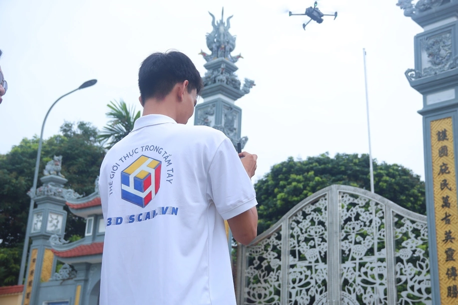
Filming with the UAV
c. VR360 and artefact photography — keeping the colour and the atmosphere
A point cloud tells you how tall a column is, but not how dark the rear sanctuary feels. The 360° spherical layer was captured with the Insta360 X5, bracketed and merged to HDR so that both deep shadow and bright doorways retain detail — the viewer walks from the courtyard into the interior, looks around and reads annotations pinned to each element.
For artefacts, 3DSCAN uses the full-frame Sony Alpha A7 III — 24.2 MP, roughly 15 stops of dynamic range. That is why the colour in the images is true to life: blazing gilt lacquer and deep shadowed wood sit inside a single frame without clipping highlights or losing detail. Its low-light capability allows work in the rear sanctuary without aiming lights directly at poonah-paper decrees or gilded wooden statues. Every artefact is photographed from multiple angles with a scale bar and an ID tag in frame, alongside notes on period, material, dimensions and condition.
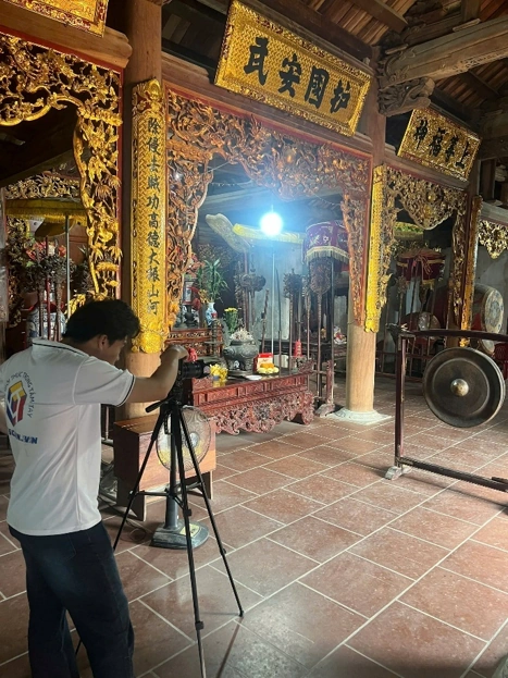
Artifact photography with the Sony Alpha A7 III
3. Deliverables — quality you can see
Standing out among the outputs are the 3D models of the triple gateway, complete with its carved ornament, and the dragon sculpture on the main hall roof — preserving the exact geometry, proportions and even the original deformation of the building before relocation.
Digitisation deliverables
| Deliverable | Format | Quality & intended use |
|---|---|---|
| Site-wide and per-element point cloud | .e57 | True colour, millimetre detail — measure dimensions and extract plans, elevations and sections anywhere |
| 3D models of the site, triple gateway and carved detail | .obj | High-resolution texture — visualisation, 3D-printed replicas, reference for machining replacement members |
| Virtual tour application | VR360 | HDR spherical imagery, continuous movement from exterior to interior, annotations pinned in place |
| Artefact and statue inventory | Images + reconciliation table | Multi-angle true-colour images with scale bar and ID — prevents loss or mix-ups during relocation |
| As-built survey report | Technical dossier | Methodology, instrument specifications, registration results and error assessment |
Source data is delivered in the open .e57 standard — vendor-independent, so it will still open decades from now, which matters more than anything else for heritage data. All data was registered and adjusted in Leica Cyclone with an accompanying error report for expert review: 3DSCAN delivers data that is verifiable, not merely a good-looking model.
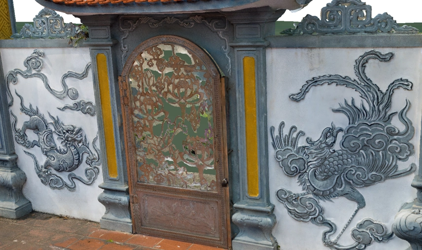
3D model image of the main gate of the Đình (communal house)
4. What this dataset is actually used for
- Dismantling documentation and member numbering: extract a section anywhere, measure each member to machine replacements at true original proportions. Where a full information model is required, this same point cloud is the direct input to a Scan to BIM workflow.
- Acceptance basis after reconstruction: rescan the rebuilt structure on its new site and compare it with the original model, measuring fidelity to the original in numbers rather than impressions.
- Artefact reconciliation: the inventory table and true-colour images track quantity and condition throughout dismantling, transport, storage and reinstallation.
- Research, exhibition and outreach: the VR360 application brings the site to the public and contributes to a digital archive of local cultural heritage.
Tinh Xa shows how 3DSCAN delivers end to end on a heritage site: 3D laser scanning, UAV photogrammetry, VR360 and artefact digitisation run together in a single survey campaign, cross-checking one another and delivered in open formats. With the same capability, 3DSCAN takes on any structure that must be recorded as-is before restoration, relocation or renovation — measured correctly, independently verifiable, delivered complete.
Related projects by 3DSCAN
- 3D laser scanning of Xa Loi pagoda — digitising a landmark of Southern Vietnamese Buddhism for conservation.
- 3D modelling of An Khanh temple — survey and 3D modelling for a heritage conservation dossier.
- 3D laser scanning of St. Joseph's Cathedral, Hanoi — recording as-built data for a French colonial landmark.
- Heritage conservation survey services — workflow, deliverables and scope of work.
Is a temple, pagoda or historic building of yours facing restoration, relocation or reconstruction? Contact 3DSCAN for a heritage digitisation plan built on 3D laser scanning, UAV, VR360 and artefact cataloguing — millimetre detail, true-to-life colour, open-format delivery with a full error report.
Contact 3DScan.vn Hotline: 0938 309 808 · Email: lienhe@3dscan.vn