3D Laser Scanning Service for Building As-Built Surveys
3D laser scanning for building as-built surveys from 3DSCAN captures site conditions with a Terrestrial Laser Scanner (TLS), producing a high-density point cloud that reflects the true geometry of the physical space. Data is tied to a coordinate and elevation system, controlled for accuracy through a survey-grade workflow, and can be used directly for as-built drawings, Scan to BIM, structural inspection, or heritage digitization.
1. What is 3D laser scanning, and what data does it produce?
3D laser scanning uses a laser beam to measure the distance from the instrument to millions of points on a surface. Data captured from multiple scan positions is registered and merged into one unified dataset called a point cloud, which can represent:
- Architecture: walls, floors, ceilings, columns, beams, elevations and architectural geometry.
- Structure and MEP: structural systems, visible piping, MEP systems, machinery and industrial equipment.
- Fine detail: complex architectural features, deformation and geometric deviation.
- Overall as-built condition of the structure at the time of survey.
Unlike traditional surveying, which captures only a limited set of feature points, laser scanning records a very large volume of geometric data simultaneously — making it well suited to complex structures or projects where returning to site for additional measurements is costly and time-consuming.
2. When should you use a laser scanning service?
Not every project needs laser scanning — for simple tasks, traditional survey methods remain economical and effective. Laser scanning earns its value when the cost of missing or incorrect as-built data outweighs the cost of the initial survey, in cases such as the following.
a. Renovation and design
When as-built drawings are incomplete or the physical condition no longer matches the records, laser scanning gives the design team direct access to 3D as-built data to check dimensions, elevations, clearances and spatial relationships before design work begins.
b. Scan to BIM
The point cloud serves as input data for building an as-built BIM model in Revit or other suitable BIM platforms, delivered as RVT, IFC, or another format on request — see 3DSCAN's Scan to BIM service for the full workflow.
c. Factories and industrial facilities
For operating factories, laser scanning captures as-built conditions before new production lines are laid out, before renovation, before MEP system changes, before equipment installation, for installation-clearance checks, or before designing supplementary structures.
d. Structural inspection and assessment
A point cloud allows geometric analysis of building elements, comparing measured data against design planes, design models, or data from different points in time — supporting checks of flatness, verticality, structural geometry and other deviations relevant to each project.
e. Digitizing architectural and heritage structures
Heritage buildings often have complex geometry that is difficult to fully capture with traditional point measurement. Laser scanning preserves the 3D geometry of a structure at the moment of survey and creates a data foundation for research, documentation, conservation and reconstruction — see 3DSCAN's heritage conservation survey service.
3. What determines the accuracy of 3D laser scanning?
A modern laser scanner can capture millions of points at very high speed, but instrument accuracy is not the same as overall project accuracy. Errors can be introduced during station setup, linking between scan stations, point cloud registration, coordinate transfer, data processing, or merging multiple survey areas. So a laser scanning project intended for engineering use should not only ask "how accurate is the scanner," but also answer "how accurate is the processed data, and how was that verified?"
Final accuracy depends on many factors at once: the instrument, scan distance, angle of incidence, station density, surface material, registration method, control network, project scale and QA/QC process. For suitable detailed work, TLS can deliver data at the millimeter level, but each project's accuracy requirement must be defined in advance and verified against real data — a requirement of ±3 mm for one technical component versus ±10 mm for another as-built task calls for two very different survey plans and cost levels.
"3DSCAN's scan data was even better than the data they had received."
— Mr. Yen, an engineer who has worked on BIM modeling at Singapore's Changi Airport
4. What makes 3DSCAN's laser scanning service different?
3DSCAN does not treat the laser scanner as the whole solution. Project capability is built on three components:
- Geodetic survey: coordinate and elevation systems, control networks, measurement and error-checking methods — built on a surveying foundation, laser scan data can be tied to the appropriate coordinate and elevation system via GNSS, total station, control monuments, or independent verification methods.
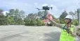
- Specialized equipment: a terrestrial laser scanning system matched to survey requirements, including the Leica RTC360 for projects needing detailed, efficient field data capture. Instrument choice, station density, scan range and control strategy are determined per project rather than applying one fixed process to every job.
- Technical operations: after capture, the point cloud is registered, checked for linkage quality and cross-referenced against suitable verification data to catch deviations before the data is used for drawings, BIM or further technical analysis — rather than simply stitching point clouds together.
These three components let 3DSCAN select the method that fits each problem, rather than forcing laser scanning onto every task. Technology is the tool — geodetic survey is the foundation that makes the data trustworthy.
5. 3DSCAN's 3D laser scanning workflow
7-step as-built data process
| Step | Scope of work |
|---|---|
| 1. Define the data's end use | Determine whether the data serves design, BIM, inspection, renovation, conservation or as-built archiving — the end use drives the level of detail and survey plan. |
| 2. Survey and plan the measurement approach | Assess area, structure, obstructions, sightlines and the required coordinate system; define the station network and data-control plan. |
| 3. Establish control where needed | For projects requiring data tied to a coordinate system or a high level of geometric control, monuments and check points are set up to match the technical requirement. |
| 4. Field laser scanning | Scan stations are positioned to ensure coverage and limit occlusion; station count can range from a few dozen to hundreds or thousands depending on the project. |
| 5. Point cloud registration | Data from all stations is registered into a single unified point cloud — one of the steps with the most direct impact on final data quality. |
| 6. QA/QC | Checks cover station-to-station linkage, areas at risk of deviation, control/check points where applicable, overall geometry, coordinate and elevation systems, and data completeness. |
| 7. Product processing | From the point cloud, 3DSCAN can continue into 2D CAD, Scan to BIM, 3D models, as-built analysis, GIS data or Web 3D. |
6. What deliverables do clients receive after a laser scan?
Depending on the scope of the engagement, clients do not have to purchase every deliverable up front — a well-captured, well-managed point cloud can continue to be used as new needs arise later in the project.
Deliverables and formats
| Deliverable | Format / content |
|---|---|
| Point cloud | E57, RCP/RCS or a format compatible with the client's software. |
| As-built drawings | Floor plans, elevations, sections and technical drawings extracted from the point cloud. |
| BIM model | RVT/IFC or another BIM format on request. |
| 3D model | For design, analysis, presentation or facility management. |
| Web 3D data | View and explore data through a web environment, on projects where this applies. |
7. How does laser scanning reduce project costs and extend the data's lifecycle?
The biggest cost of as-built data is not necessarily the survey itself — it is what tends to happen after the survey: designing from incorrect dimensions, having to return for additional measurements, discovering clashes once construction has started, a BIM model that no longer matches site conditions, new equipment that does not fit, missing data in critical areas, or different teams working from different datasets. The real value of laser scanning is therefore not just faster measurement, but a single, unified as-built dataset that multiple teams can share.
Rather than stopping at "survey → deliver drawings → done," 3DSCAN carries the data through the project lifecycle: as-built survey → point cloud → design/BIM → construction → as-built record → GIS/Web 3D → management, renovation and expansion. The original survey data gradually becomes a data asset for the project, rather than a one-time deliverable.
8. Applications of 3DSCAN's laser scanning service
3DSCAN focuses on work where data completeness and reliability create real value:
- Factories and industrial facilities; renovation projects; offices and commercial buildings.
- Complex architectural structures; Scan to BIM; structural inspection and survey.
- Heritage digitization; buildings that require as-built documentation; owners who need 3D data for long-term facility management.
- Small-footprint projects with high quality requirements — a category where missing a few positions or having to re-survey can end up costing more than investing in a solid dataset from the start.
9. Laser scanning pricing
Every project has different site conditions and technical requirements, so 3DSCAN does not apply a fixed rate across all projects. Survey cost is determined by the scale of the structure, its complexity, the density and number of scan positions, required accuracy, the coordinate/elevation system, site conditions, deliverables and the required schedule.
Before quoting, 3DSCAN discusses with the client to establish the intended use of the data, then proposes a survey scope and processing level that fit that use — avoiding capturing or processing more data than is actually needed. Clients can send drawings, area, as-built photos/video and their target deliverables; 3DSCAN then evaluates the request and prepares a technical proposal with a corresponding quote.
To prepare a suitable proposal, clients only need to provide:
- Project location.
- Area or a preliminary drawing.
- As-built photos/video, if available.
- Intended use of the data.
- Desired deliverables.
- Required schedule.
3DSCAN will propose a suitable data capture and processing method before preparing the quote.
Conclusion
3DSCAN delivers 3D laser scanning services on a geodetic survey foundation, combining specialized TLS equipment with a QA/QC process that controls accuracy at every step — ensuring the data is not just "scanned," but correctly positioned, correctly sized, verifiable, and ready to use for design, BIM or inspection. Every survey plan is proposed to match the specific data-use case of each structure.
Related projects by 3DSCAN
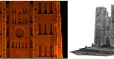
- 3D laser scanning of St. Joseph's Cathedral, Hanoi — preserving survey data for heritage conservation.
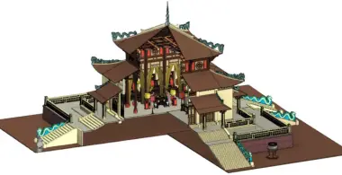
- 3D laser scanning for the conservation of Xa Loi Pagoda — as-built survey of a complex architectural structure.
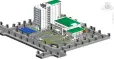
- Scan to BIM combined with underground utility detection — RMIT University, District 7 — point cloud data as the foundation for an as-built BIM model.
- Scan to BIM service page — full workflow, LOD levels and deliverables.
Need a 3D laser scan survey for your building? Send 3DSCAN some basic project information and get advice on the right survey approach and pricing.
Contact 3DSCAN Hotline: 0938 309 808 · Email: lienhe@3dscan.vn