3D Scanning of Diamond Island Villa – ±2cm Accuracy, View Live in a Web Viewer
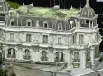
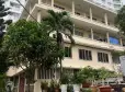
A villa dressed in ornate cornices, wrought-iron railings and classical domed roofs — measure it with a tape measure and you'd need a week, and still miss half the detail. 3DSCAN captured the entire existing condition of Diamond Island Villa (District 2, Ho Chi Minh City) in just one day of fieldwork, combining RTK drone photogrammetry with Leica RTC360 laser scanning to produce a truly measurable digital twin: ±2 cm accuracy, dense point coverage that misses nothing, and true-to-life color down to every brick and wall surface.
Talk to Us About Your 3D Scanning Project
1. A Modern Scanning Method — Fast Without Sacrificing Accuracy
Speed and accuracy are usually at odds — unless you use the right tool for the right spot. That's the operating principle 3DSCAN followed on this project:
- GNSS RTK control network (Stonex S900): ground control points (GCPs) anchor the entire model to the national VN2000 / UTM Zone 48N coordinate system.
- RTK aerial photogrammetry (DJI Mavic 3 Enterprise): nadir and oblique flights at 25–40 m altitude with 80/70% overlap, rapidly covering the roof and every façade.
- Static laser scanning (Leica RTC360): 2 million points per second with an integrated HDR camera, filling in exactly what the drone can't see — interiors, roof undersides, corners hidden behind trees.
- Registration & processing: RealityCapture/Metashape for the photogrammetric block, Cyclone Register for the laser scan data, merged into one coordinate system and cross-checked with a Leica TCR802 total station.
2. Three Qualities That Define Real Data Value
Why These Three Factors Determine a Building's Data Value
| Factor | Value It Delivers |
|---|---|
| ±2 cm accuracy | Take dimensions straight from the model onto construction drawings — no need to re-measure on site. |
| Full point density | Preserves cornices, grout lines and door edges intact — nothing gets interpolated or "rounded off." |
| True-to-life color | Records the material's real condition — the evidence base for assessing deterioration and matching replacement materials. |
3. The Result: Fast, Detailed, Diverse Data, Viewable Instantly on the Web
Just 2–3 days from fieldwork to delivery, and the owner receives a complete, multi-format dataset ready for immediate use across several purposes:
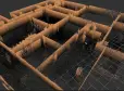
- Colorized point cloud (LAS/LAZ/E57/RCP): imports directly into Revit or AutoCAD for as-built drawings.
- 3D mesh (OBJ/FBX): for rendering renovation concepts and presenting perspectives.
- Orthophotos & DEM: for calculating roof and yard areas and designing drainage.
- 3D Web Viewer: opens right in a browser, no software required — owners, architects and contractors can view, rotate and measure together from a single link.
Need accurate as-built data you can view instantly on the web and receive within days? 3DSCAN's team handles the entire chain from field scanning to digitization and model building, with quality assured at every stage.
Contact 3DScan.vn Hotline: 0938 309 808 · Email: lienhe@3dscan.vn