Developing a Detailed 3D Model of Diamond Island Villa – For Design and Renovation
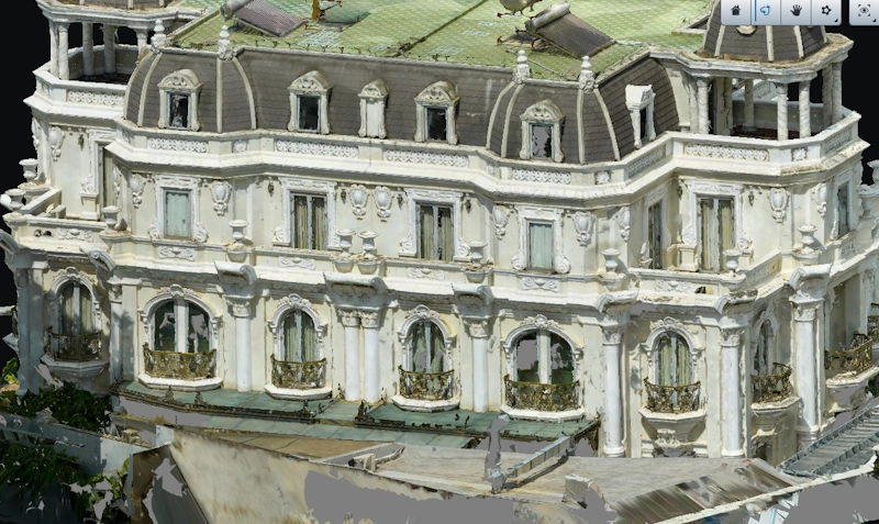
3DScan.vn carried out a project to develop a detailed 3D model for a luxury villa located on Diamond Island – District 2, Ho Chi Minh City, serving design, renovation, and repair purposes. Data was collected using a DJI Mavic 3E UAV with an accuracy of ±2 cm, enabling the reconstruction of the entire structure with precise coordinates, elevations, and online 3D visualization.
Contact us for UAV-based 3D modeling
 1. Project Objectives and Scope
The project aims to digitize the architectural space of the existing villa on Diamond Island, creating an accurate 3D dataset to support interior and exterior renovation design, structural assessment, and technical documentation. 3DScan.vn applied a UAV-based photogrammetry solution to capture the entire area and generate a highly detailed 3D model aligned with geographic coordinates and standard elevation systems.
- Location: Diamond Island Villa, District 2, Ho Chi Minh City.
- UAV Equipment: DJI Mavic 3E – RTK sensor, 20 MP image resolution.
- Accuracy: ±2 cm after GCP adjustment.
- Flight Coverage: Entire villa compound and surrounding landscape.
- Deliverables: Georeferenced 3D model, orthophoto, DEM, and online 3D viewer.
 2. Technical Workflow
The workflow follows professional UAV photogrammetry standards, combined with Ground Control Points (GCP) to ensure absolute positional and elevation accuracy.
a) Preparation and Site Survey
- Deploy GCPs across the entire villa area, measured using GNSS RTK.
- Survey the site, define flight paths, capture height, and optimal image overlap.
b) UAV Data Acquisition with Mavic 3E
- Flight altitude: 25–40 m, with 80/70% overlap for smooth and continuous 3D reconstruction.
- Capture façade, roof, and surrounding landscape imagery.
- All images are geotagged with high accuracy using the integrated RTK system.
c) Data Processing and 3D Modeling
- Process imagery using professional software (RealityCapture / Metashape).
- Reconstruct a detailed 3D model aligned to UTM 48N – VN2000 coordinate system.
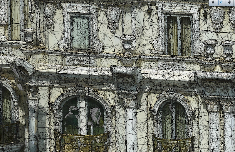
- Generate Mesh and textured models for online visualization.
- Validate elevation accuracy, ensuring ±2 cm spatial precision.
 3. Results and Applications
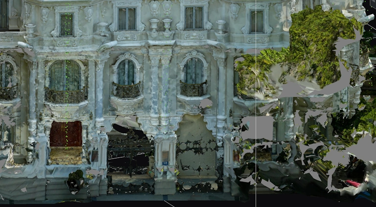
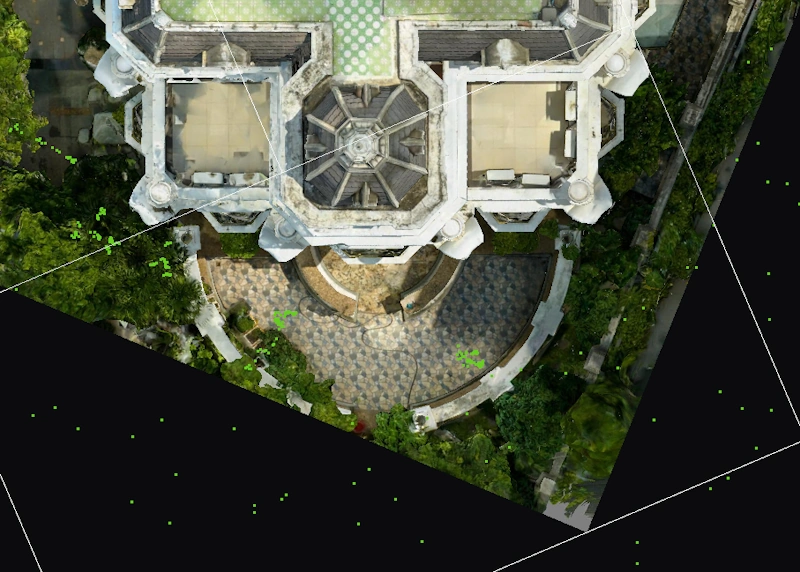
Upon completion, 3DScan.vn delivered a comprehensive dataset including a georeferenced 3D model, orthophoto, topographic data, and online visualization model. This dataset enables architects and engineers to accurately assess existing conditions, design renovations, and optimize construction planning.
- Georeferenced 3D model: supports measurement, quantity take-off, and dimensional verification.
- Online visualization: accessible via web browsers using Cesium or Potree.
- Design integration: export formats (FBX/OBJ) compatible with Revit, SketchUp, and BIM workflows.
- Long-term data storage: supports maintenance, renovation, and asset management.
 Conclusion
The project “Developing a Detailed 3D Model of Diamond Island Villa” demonstrates 3DScan.vn’s expertise in applying UAV photogrammetry technology with high accuracy. The resulting 3D model is fully georeferenced, accurately representing geometry, materials, and surroundings, directly supporting design, renovation, and facility management.
Need a detailed 3D model using DJI Mavic 3E UAV for design, renovation, or asset management? 3DScan.vn provides UAV Photogrammetry – 3D Modeling – Online Viewer services with high accuracy and VN-2000 georeferenced data.
Contact 3DScan.vn Hotline: 0938309808 · Email: lienhe@3dscan.vn