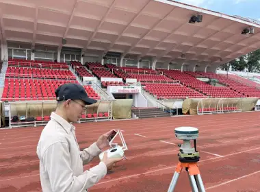
3D topographic survey of the 220 ha Tây Bắc Industrial Park for 1:500 detailed planning
3DSCAN carried out a 3D topographic survey covering 220 ha at Tây Bắc Industrial Park, working as a subcontractor alongside Quy Hoạch Xanh Company. The main deliverable is a 1:500 topographic map, the existing-condition data that feeds the detailed planning design. The survey team combined UAV-based 3D topographic surveying, LiDAR, GNSS and levelling, then added RTK measurements at locations that needed direct checking.
Talk to us about 3D topographic surveys
1:500 detailed planning starts with the existing elevations of the whole site
For an area earmarked for industrial planning, existing-condition topographic data is the basis for setting elevations, drainage direction, internal road layout and the site grading approach. Across 220 ha, the data capture method has to cover a wide area while still allowing checks at locations that are hard to see from the air.
3DSCAN was responsible for the topographic survey, spatial data processing and handover of deliverables to the planning firm. 3DSCAN is not the author of the detailed planning scheme; the survey data is an input to the consulting team's design work.
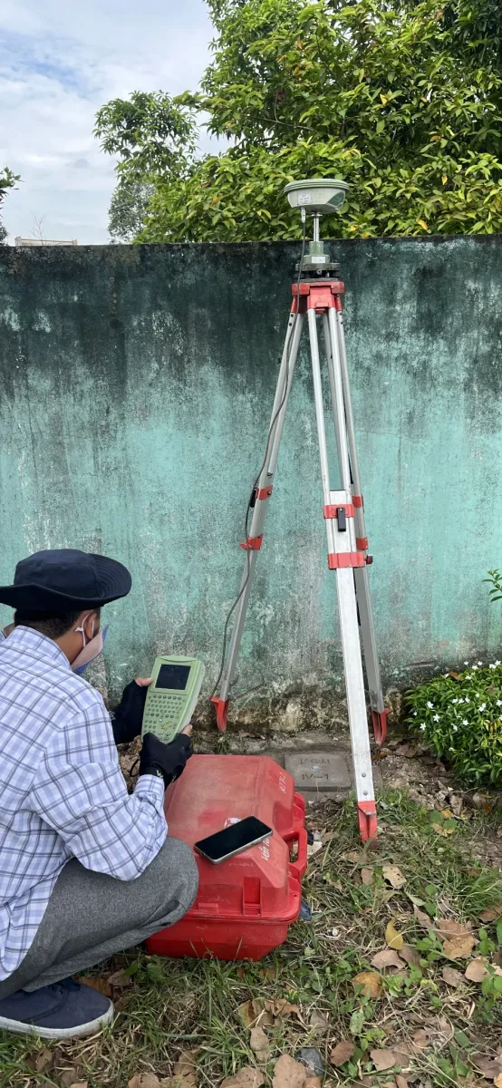
3DSCAN engineer setting up a GNSS receiver on a tripod over control mark KCN IV-1 at Tây Bắc Industrial Park
UAV LiDAR covers the area, ground surveying keeps the data reliable
The survey plan splits the work clearly: UAV LiDAR captures surface data across the entire site, while GNSS, levelling and RTK maintain the coordinate and elevation framework and check the spots where flight data is not clear enough.
Illustrative cross-section of each method's role in the Tây Bắc Industrial Park project
DJI Matrice 300 RTK UAV with Zenmuse L1
3DSCAN used the DJI Matrice 300 RTK with the Zenmuse L1 LiDAR sensor to capture point clouds and imagery across the survey area. LiDAR helps record terrain form, especially in vegetated areas where aerial photos may not see enough of the ground. After capture, the data is classified, adjusted and checked against field-measured points before going into map compilation.
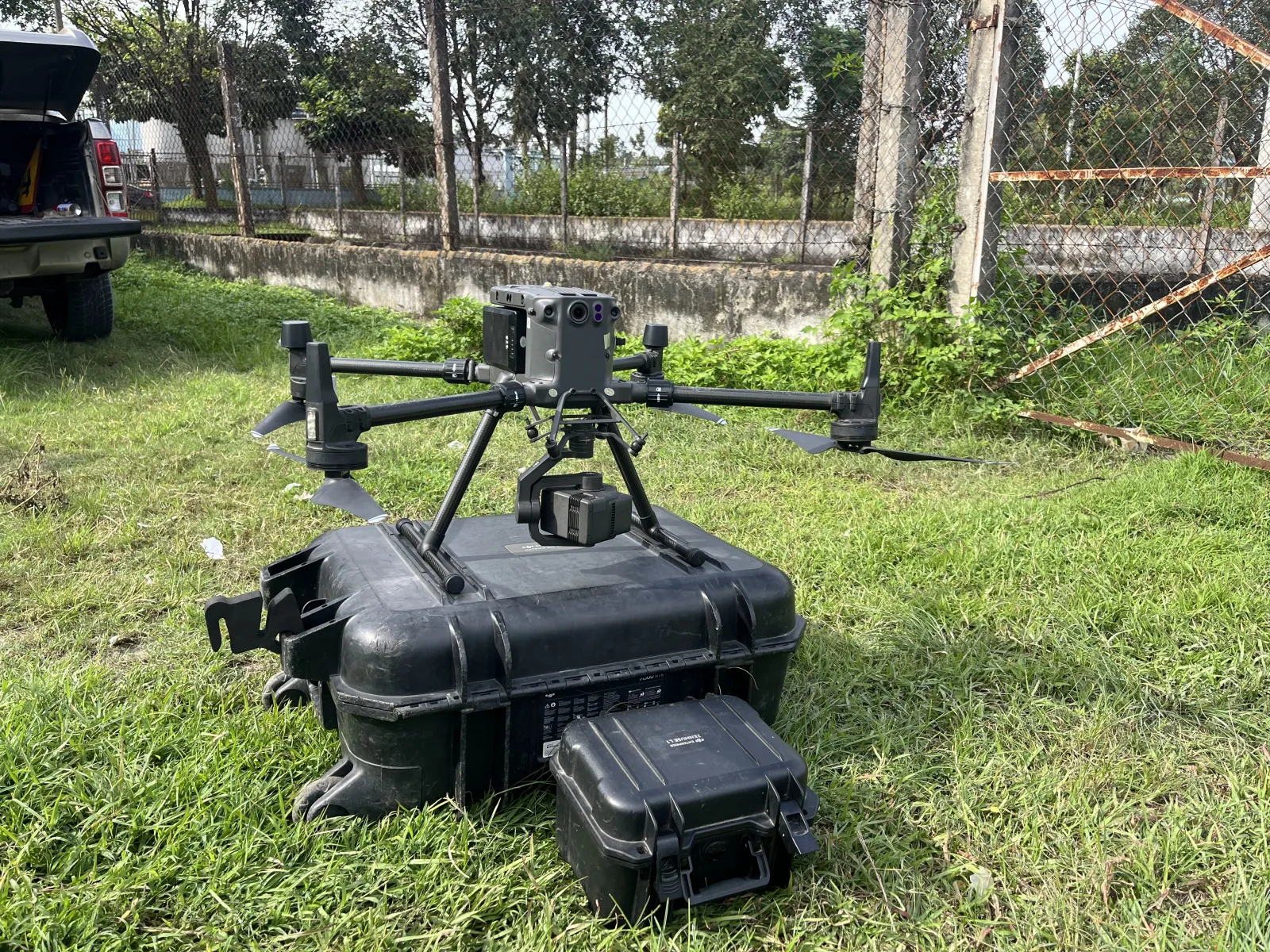
Matrice 300 RTK UAV and Zenmuse L1 sensor case on site at Tây Bắc Industrial Park
GNSS and levelling
GNSS and levelling were used to establish, link and control the coordinate and elevation framework for the survey data. This step is what allows the UAV data layers and the ground-measured points to be used consistently in a single topographic map.
Supplementary RTK in flooded and obstructed areas
Where features or elevations needed clarifying, particularly areas with water and points that are hard to determine directly from flight data, the survey team added RTK measurements wherever the location could be reached safely. An important distinction: airborne LiDAR does not inherently measure the terrain beneath water. Water surfaces and flooded areas must be assessed and checked with a suitable method.
“In areas with water, we don't use airborne LiDAR data to infer bottom elevations. Wherever a true elevation is needed, someone has to carry an RTK pole there and measure it; wherever the spot can't be reached safely, we state that clearly in the handover documents so the planning team knows the limits of the data.”
— Phan Tiên Duyên, Director, 3DSCAN Technology Co., Ltd.
Choosing the method by site condition
| Condition / task | Primary method | How it is controlled |
|---|---|---|
| Wide-area terrain surface, including vegetated zones | Matrice 300 RTK + Zenmuse L1 (LiDAR and imagery) | Classification, adjustment, comparison with field-measured points |
| Coordinate framework for all data | GNSS | Positional control of the data |
| Elevation framework | Levelling | Linking and controlling elevation |
| Areas with water, points hard to determine from flight data | Field RTK at safely accessible locations | Adding and checking terrain points |
| Bottom of flooded areas | Airborne LiDAR not assumed | Assess conditions, choose a suitable measurement method |
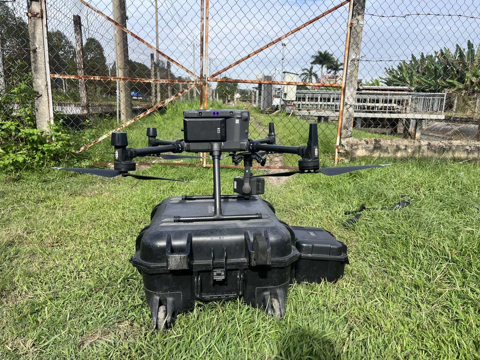
DJI Matrice 300 RTK with Zenmuse L1 before a data capture flight at Tây Bắc Industrial Park
One survey campaign, four types of deliverables
Beyond the technical map, the project also delivered visual data so the planning consultants could assess the terrain as a whole. According to the project information, the deliverables are:
- 1:500 topographic map for detailed planning.
- 3D terrain model showing the landform of the survey area.
- Web link for viewing the orthophoto to look up existing site context.
- Web link for viewing the 3D model so project partners can inspect the site remotely.
Each project member uses the part of the data that fits their discipline: engineers work with the survey figures, while the investor and planning team get an overall view of the site. The dataset can be developed further toward 3D modelling from UAV and LiDAR data, combined with planning data standardisation and GIS when the project needs further use of it.
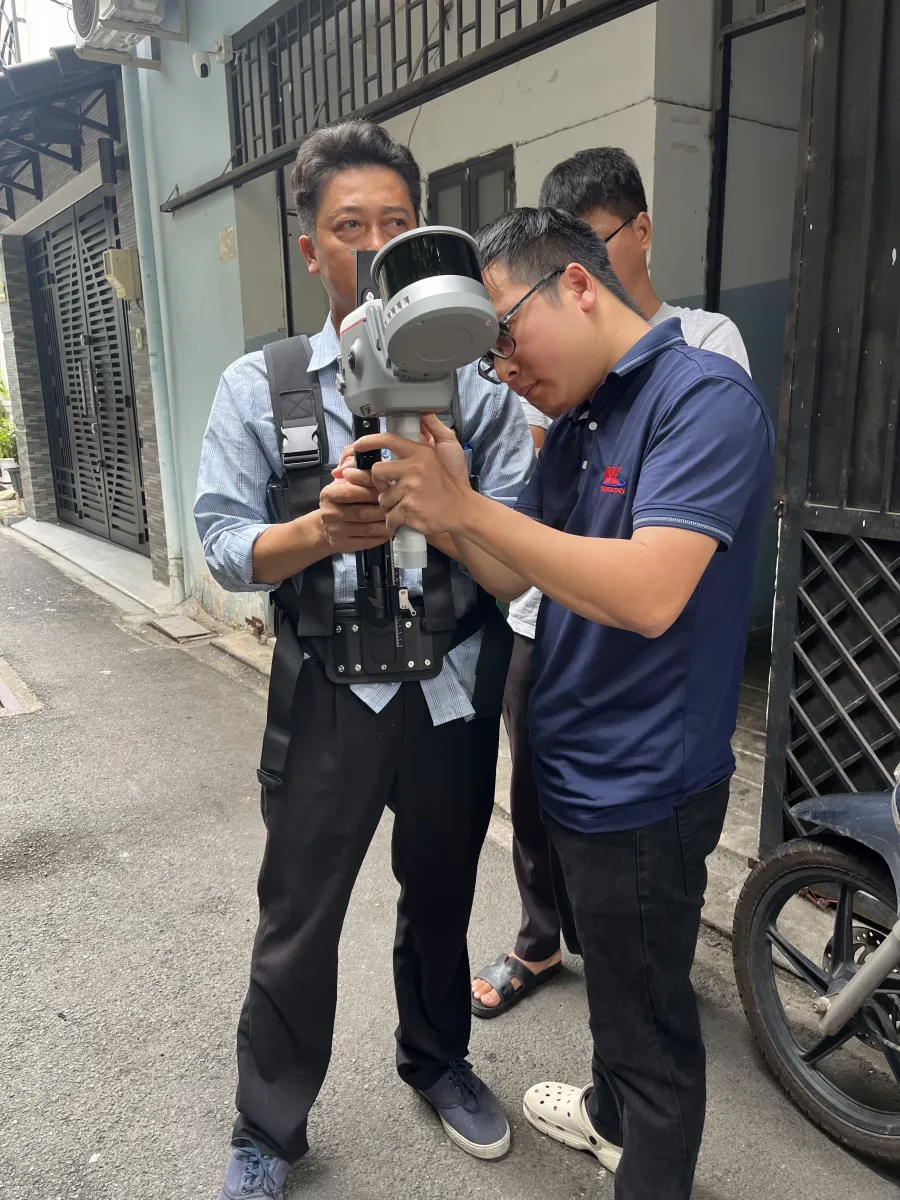
Engineers operating a handheld SLAM laser scanner
The 3D model lets you read the 1:500 map in space
Across 220 ha, the 3D terrain model adds a spatial view to the 1:500 topographic map. The consulting team can see elevation relationships between zones, check feature locations and compare against existing conditions while developing the planning scheme. With online viewing links, the survey firm, the planning firm and the investor can discuss the site without relying entirely on printed sheets.
The 2D map and the 3D data are not separate products; they come from the same survey campaign. The topographic map serves design work, while the orthophoto and 3D model are used for checking and communication.
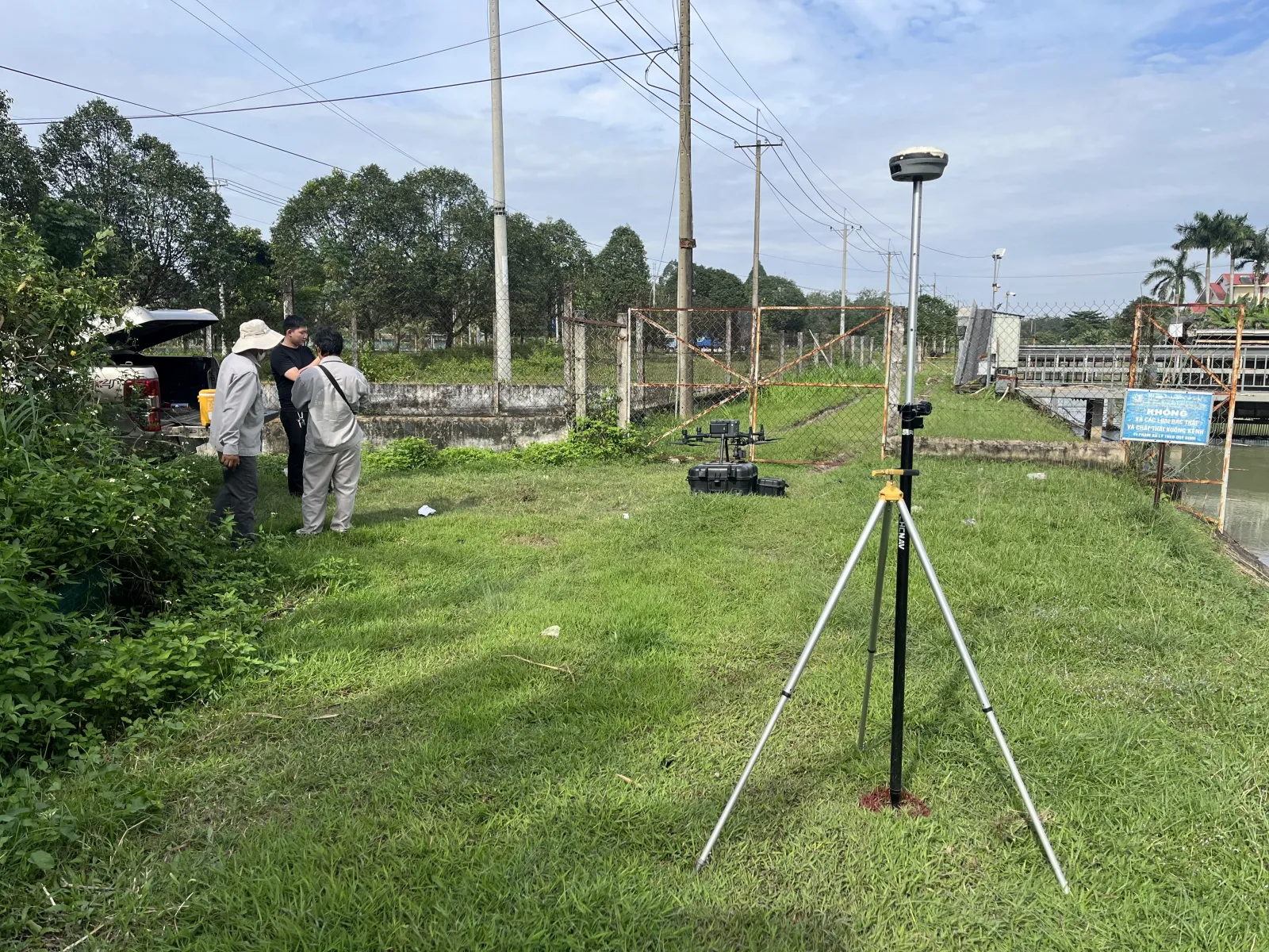 3DSCAN survey crew preparing a Matrice 300 RTK flight
Conclusion
The Tây Bắc Industrial Park project shows how 3DSCAN carries out wide-area 3D topographic surveys for detailed planning: UAV LiDAR paired with coordinate and elevation control and supplementary field measurement, delivering a 1:500 map, a 3D model and web-based data viewers. 3DSCAN is headquartered in Ho Chi Minh City, has delivered projects in many provinces, and is ready to work with planning consultants, designers and investors to build existing-condition databases that can be verified and used over the long term.
Related projects and services by 3DSCAN
- UAV 3D topographic survey service: scope and applications for planning and design.
- UAV surveying in construction and infrastructure: data capture, processing and use.
- Scan to BIM with utility detection and topographic survey at RMIT District 7: an existing-condition survey project in Ho Chi Minh City.
- 3D model of Tân Huê Viên tourist area: spatial data for a large site.
- Converting planning data to GIS: the next step for using digital data.
Need a 1:500 topographic survey, 3D model or orthophoto for a planning project? Contact 3DSCAN to discuss a survey approach that combines UAV LiDAR and ground surveying to suit your site conditions.
Contact 3DSCAN Hotline: 0938 309 808 · Email: lienhe@3dscan.vn