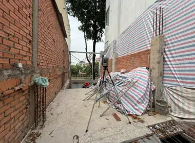
MEP Scan to BIM at LOD 300 with the Leica RTC360 in HCMC
3DSCAN Technology Co., Ltd. builds MEP models at LOD 300 (mechanical, electrical, plumbing) from Leica RTC360 laser scan data: the scanner samples surfaces at a finest point spacing of 3 mm at a 10 m range, a 3D point accuracy of 1.9 mm at 10 m and a maximum rate of 2,000,000 points per second (Leica Geosystems datasheet). That density makes it possible to read the diameter, centerline and elevation of every pipe run in a cramped service room, where water pipes, ducts, cable trays and insulated pipes stack in several layers on top of one another. The quality of the delivered model does not come from the instrument specification alone: it is secured by the scan plan, control over the registration data and the step of checking the model against the point cloud after modeling — the full Scan to BIM workflow at 3DSCAN.
Get advice on an MEP Scan to BIM plan
1. Why MEP is the hardest system to survey for BIM
MEP is hard because the runs sit close together and hide one another, while the model still has to pin down the exact size, elevation and position of each run. A typical service zone in a factory — a ceiling corridor 2.5 m wide, service-ceiling height 3.5–4.5 m — usually has four to six layers stacked vertically: electrical cable trays on top, rectangular ducts in the middle, fire-fighting and chilled-water pipes below, interleaved with insulated pipes and hangers.
Four groups of difficulties recur on almost every project:
- Layered occlusion: a lower run hides the underside of the run above it; a single scan station only sees the surface facing the instrument.
- Tight space: the gap between two pipe runs is sometimes only 50–100 mm, leaving no room to place the tripod in every direction you would want.
- Varied materials: shiny galvanized steel, black uPVC/HDPE plastic pipe, vulcanized rubber, insulation wrapped in silver foil or black jacketing — each returns the laser signal differently.
- Direction-change details: 45°/90° elbows, tees, reducers, valves, flanged connections — these are the points that decide whether the model is usable for construction or not.
So the first task on any MEP project is not choosing the instrument, but locking down the list of objects to be modeled: the smallest diameter to be modeled (for example DN50 and above), whether hangers and support rods are modeled, whether pipes inside walls are modeled or only the exposed portions, whether insulated pipe is split into two objects (pipe + insulation layer) or merged into one. This list must be in the contract, because it governs both the volume of scanning and the volume of modeling.
2. What information does LOD 300 require from the scan data?
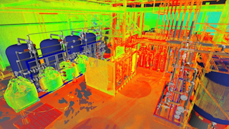
Theo BIMForum LOD Specification, an element at LOD 300 is modeled as a specific object, defined in terms of quantity, size, shape, location and orientation, and measurable directly from the model without referencing external information. For MEP systems, the scan data must supply all four of the following groups of information.
- Size: outer diameter of round pipe, cross-section of rectangular duct, cable-tray width, thickness of the insulation layer.
- Shape: the fitting type at each direction change — elbow, tee, reducer, valve — and the bend radius of curved segments.
- Location: centerline coordinates in the project coordinate system, and distances to grid lines, walls and neighbouring runs.
- Orientation: the direction of the run, drainage slope, and the elevation of the duct bottom and pipe top relative to finished floor level.
An important note on tolerance: LOD 300 describes the level of development of the model element; it does not itself set a millimetre survey tolerance. The figure of 1.9 mm at 10 m is the scanner's 3D point accuracy from the datasheet, not the accuracy of the delivered model. The model tolerance, the scope of objects to be modeled and the checking method must be agreed in writing between the owner and the survey firm before work begins.
3. How high point density helps identify MEP geometry
A pipe is only modeled correctly when enough measured points are distributed over its cylindrical surface. The Leica RTC360 offers three point-spacing settings: 3 mm, 6 mm or 12 mm at a 10 m range (Leica Geosystems datasheet). Point spacing is proportional to range, so in the 3 mm @ 10 m mode the same instrument gives a point spacing of about 1.5 mm at 5 m and about 6 mm at 20 m.
Cross-section of a DN100 pipe (114 mm outer diameter) at 10 m: the 3 mm mode gives about 60 points on the half-circumference facing the instrument, the 12 mm mode only about 15. Geometric estimate from the nominal point spacing in the datasheet.
a. Why the number of points on the cross-section decides the modeled diameter
The diameter and centerline of a round pipe are interpolated from the set of points on its cylindrical surface. With around 60 points on the half-circumference, the cylinder-fitting algorithm has enough redundancy to reject noise points and return a stable radius; with 15 points, every noise point pulls the result off and the modeler is forced to "guess" the diameter from experience and assign the nearest commercial pipe size. Being one size off — DN100 becoming DN125 — is a 25 mm discrepancy on the coordination drawing, enough that a pre-fabricated pipe segment will not fit.
b. Scanning from multiple directions to fill in what is hidden
High point density does not solve occlusion — only the number and position of scan stations solve it. 3DSCAN's working principle in service spaces: each stacked pipe cluster needs at least three to four offset scan directions, including at least one low station to capture the underside of ducts and one station offset from the corridor axis to capture pipe hidden by hangers. With the RTC360, a scan station finishes in under two minutes in standard mode, so adding stations to fill in occlusion costs far less field time than returning to re-measure after discovering missing data.
Leica RTC360 specifications directly relevant to MEP surveying
| Specification | Published value | Meaning for MEP systems |
|---|---|---|
| 3D point accuracy | 1.9 mm @ 10 m · 2.9 mm @ 20 m · 5.3 mm @ 40 m | Basis for placing stations close to the pipe cluster that needs the highest reliability |
| Range accuracy | 1.0 mm + 10 ppm | Directly affects the interpolated cylinder radius |
| Point spacing | 3 / 6 / 12 mm @ 10 m (selectable) | Choose 3 mm for service zones, 6 mm for open space |
| Scan speed | Up to 2,000,000 points per second | Allows adding stations to fill occlusion without extending the schedule |
| Measuring range | 0.5 m – 130 m | Measures even pipe clusters close to the instrument in a cramped pump room |
| Angular accuracy | 18″ | Stable measuring-beam direction when scanning high ceilings |
| Distance measurement | High-dynamic time-of-flight, WFD technology; Class 1 laser, 1550 nm wavelength (invisible) | Safe for scanning in an operating factory with people passing by |
| Tilt accuracy | 18″ within a ±5° range when High Tilt Accuracy is enabled (firmware 5.0); outside that range it is 3′ | Controls the vertical when determining pipe-bottom elevation |
Source: Leica RTC360 datasheet and Leica Geosystems High Tilt Accuracy technical documentation. The applicable range of High Tilt Accuracy depends on the firmware version of each instrument.
4. How accuracy and tilt compensation support position and elevation
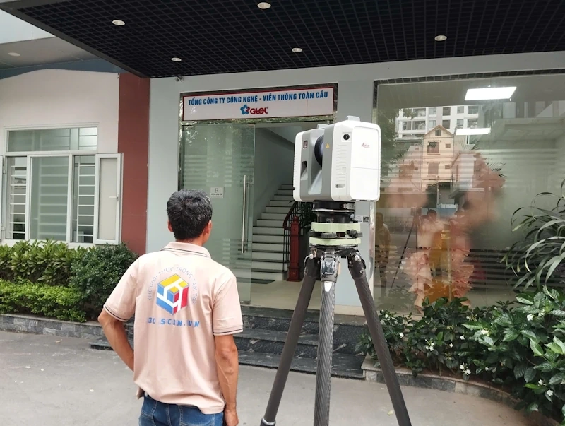
The elevation of the duct bottom and the pipe centerline are only trustworthy when the vertical of the data is correctly established. On the RTC360, the High Tilt Accuracy feature (introduced in firmware 5.0) reprocesses the IMU data captured during the 360° rotation to improve levelling accuracy to 18″ within a ±5° tilt range, replacing the previous 3′ level — according to Leica Geosystems, this is an improvement in the IMU-data processing algorithm, not a mechanism that compensates for vibration during scanning.
Translated to the field: an 18″ vertical deviation corresponds to under 1.7 mm at 20 m and about 3.5 mm at 40 m; at the 3′ level, the same 20 m range can reach a deviation of about 17 mm. Over a long service corridor, that difference is enough to distort the calculated slope of a drainage run.
Three kinds of deviation that must be kept strictly separate
Clients often lump every figure together as "the accuracy of the model." In reality there are three different quantities that accumulate in a chain:
The deviation chain from instrument to model: point accuracy (1.9 mm at 10 m per datasheet) → registration error (assessed by RMS in the registration report) → modeling deviation (model checked against point cloud to the threshold agreed in the contract).
"In a cramped service room, what decides model quality is not the 1.9 mm figure on the datasheet, but the number of scan directions we manage to set up around the pipe cluster. One station gives you half of a pipe; it takes three or four angled stations to get enough of the cylinder to interpolate the centerline and diameter. And the only figure we commit to the owner is the deviation between the model and the point cloud — measurable, and re-checkable."
— Mr. Phan Tiên Duyên, Director, 3DSCAN Technology Co., Ltd.
5. Capturing data on dark materials and hard-to-measure surfaces
Return-signal strength depends on the surface material, range and angle of incidence — no scanner makes a dark material reflect more strongly than its nature allows. What the RTC360 brings is a high-dynamic-range time-of-flight distance measurement using Waveform Digitising (WFD) technology, which better handles the wide signal range between strongly and weakly reflective surfaces within the same scan scene (Leica Geosystems datasheet).
Two things that are often confused need to be kept apart: low light does not affect laser distance measurement — the RTC360 uses a 1550 nm laser and measures in complete darkness; light only affects the HDR colour image mapped onto the point cloud. Conversely, materials that reflect the laser weakly (black plastic pipe, vulcanized rubber, insulation wrapped in black fabric) are what degrade point quality, and the solution for that is the scan plan, not lighting.
How 3DSCAN handles weakly reflective surfaces in the field
- Shorten the range: place stations closer to the black pipe cluster instead of scanning from afar — 3D point accuracy rises from 1.9 mm at 10 m to 5.3 mm at 40 m, so a short range gives a double benefit in both signal strength and accuracy.
- Improve the angle of incidence: a laser beam striking near-perpendicular to the surface returns a much stronger signal than a grazing beam; this dictates where the tripod is placed.
- Increase overlap: the same pipe segment is captured from several stations, so points missing at one station are filled by another.
- Check on site immediately: preview the point cloud on the instrument after each station to spot sparse areas and re-scan on the spot, rather than discovering the gap back at the office.
- Record limits in the report: if a pipe segment still lacks data, note its location and the supplementary measurement method (tape, total station) in the file, and do not model by guesswork.
To prove the advantage quantitatively on each material, the only honest way is a trial measurement at the actual site: scan the same black pipe segment at different ranges and angles of incidence, then compare the point density obtained. 3DSCAN is willing to carry out this trial survey before signing a contract for projects with a high proportion of dark materials.
6. From point cloud to a verified MEP model at LOD 300
Raw scan data is not the product. 3DSCAN's workflow from field to delivered model has four steps, each with its own checking criteria.
Four steps from field to MEP model at LOD 300: multi-direction scanning in 3 mm @ 10 m mode → Cloud-to-Cloud registration and RMS check → cutting cross-sections and interpolating cylinders and centerlines → modeling in Revit then overlaying back on the point cloud for verification.
a. Registration and data control
The scan stations are registered by the Cloud-to-Cloud method; the result is assessed by the RMS figure in the registration report and by visually checking reference planes (floor, wall, beam) for "doubling" caused by misalignment. The registration report is a mandatory document in 3DSCAN's handover file — without it, every commitment on model accuracy is unverifiable. This is also the step applied to all architectural existing-condition 3D laser scan data before it moves on to modeling.
b. Modeling and post-modeling verification
The MEP model is built in Revit using object families with real parameters (diameter, material, system), not hollow geometric blocks. Once built, the model is overlaid back on the point cloud and checked run by run: cross-sections are cut at representative locations, the offset between the modeled pipe's outer surface and the scan points is measured, and a list of over-threshold locations is compiled for correction. The items checked include: the diameter of each run, the elevation of the duct bottom and pipe centerline, the position of elbows and tees, the gap between runs, and completeness against the object list locked in the contract.
7. Proven delivery capability and the practical value of the model
The workflow above has been applied by 3DSCAN at factory scale. On the Scan to BIM project at the First Solar solar-panel factory in Củ Chi, the published volume and results are as follows:
Delivery evidence — First Solar, Củ Chi
| Item | Result |
|---|---|
| Scan volume | 700 scan stations, completed in 3 field day |
| Registration | Cloud-to-Cloud (ICP), average RMS error < 5 mm |
| Model level | LOD 350 for architecture, structure and MEP |
| Total time | 8 days (3 day scanning + 5 days processing and modeling) |
| Deliverables | Point cloud in .LGS and .E57, Revit model including walls, steel structure, floors, ceilings and service pipes |
Figures per the project file published on 3dscan.vn.
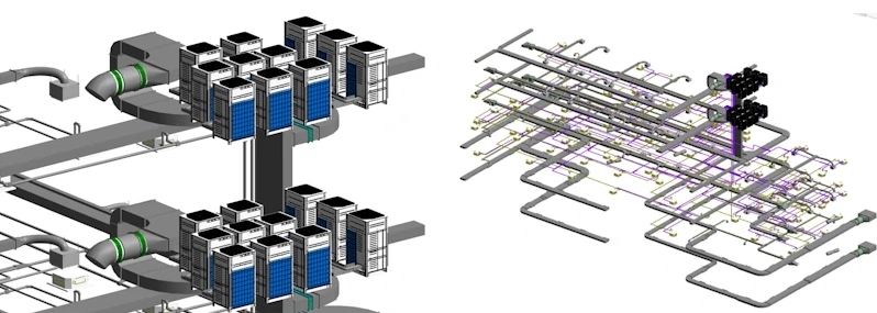
A properly verified MEP model at LOD 300 directly serves three groups of work: routing new runs in the real remaining space of the service ceiling rather than from old as-built drawings; assessing installation space — checking whether new equipment has enough clearance to be moved into place and enough room for maintenance; and supporting design coordination across disciplines, catching clashes between new MEP and existing conditions on the model before going to site. For projects that need underground utility data as well, the ceiling MEP model is merged with utility-detection data, as 3DSCAN did on the RMIT Nam Sài Gòn project.
8. Conclusion
The Leica RTC360 supplies the input data: point density down to 3 mm at 10 m, 3D point accuracy of 1.9 mm at 10 m and the ability to control the vertical at 18″ when High Tilt Accuracy is enabled. The rest — the station plan to fill occlusion, quality control of registration, and the step of checking the model against the point cloud — is the engineering work that decides whether an MEP model at LOD 300 is usable for construction. 3DSCAN Technology Co., Ltd. undertakes MEP survey and modeling for operating factories, buildings and infrastructure, with a complete checking file so the owner can verify every committed figure.
Related projects by 3DSCAN
- Scan to BIM, First Solar factory, Củ Chi — 700 scan stations in 1 day, LOD 350 model for architecture, structure and MEP.
- Scan to BIM with underground detection at RMIT Nam Sài Gòn — merging ceiling service data with underground utilities and topography.
- 3D LiDAR scanning for buildings — delivery scope, equipment and data deliverables.
- 3D modeling with UAV and laser scan — a solution for projects needing roof, exterior shell and interior service data alike.
Need an existing-condition MEP survey for a retrofit, line expansion or new equipment installation? Send 3DSCAN your existing drawings (if any) and the extent of the service area, and we will propose a scan plan, the list of objects to be modeled at LOD 300 and a specific deviation-check threshold for your project.
Contact 3DSCAN Hotline: 0938 309 808 · Email: lienhe@3dscan.vn