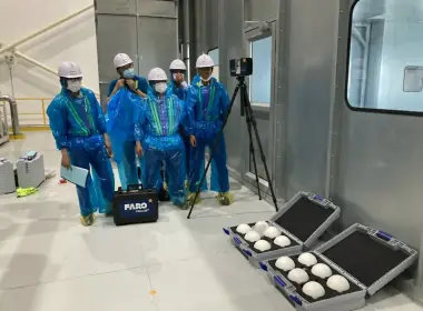
High-Quality 3D Scanning with TLS Technology – 5mm Accuracy for Every Project
Not all 3D scan data holds the same value. A sparse point cloud with color errors and uncontrolled deviation puts inspection, BIM modeling, or renovation design at risk from the very start. TLS technology (Terrestrial Laser Scanning – static laser scanning) solves exactly this: it captures millions of coordinate points per second with deviation controlled to ±5 mm, together with true-color data from an integrated imaging system. At 3DSCAN, the 3D scanning workflow is carried out by dedicated field and technical digitization teams, ensuring data reliable enough for multiple purposes: testing, structural inspection, BIM modeling, existing-condition digitization, and renovation & repair.
Get a TLS 3D scanning consultation
1. Why does 3D scan data quality determine a project's value?
3D scan data is not just for producing "a nice-looking 3D model." It is the evidence of existing conditions that engineers use to inspect structures, that architects use to build BIM true to reality, and that contractors rely on so they don't have to re-measure by hand. If the input data is sparse, highly deviated, or lacks color, every step that follows — from testing to design — must be compensated for, costing time and inviting error. Three factors determine data quality: measurement accuracy, point density, and color fidelity.
2. How does TLS technology achieve 5mm accuracy?
a) The TLS measurement principle
A static laser scanner (TLS) is fixed at each measurement station, emitting a laser beam that scans a full 360° panorama and measuring the return time/phase to calculate the distance to each surface point. Because the scanner stays still during the scan, random error from vibration is eliminated, allowing far higher accuracy than dynamic scanning methods (handheld SLAM, UAV).
b) High point density, fully detailed data
TLS instruments such as the Leica RTC360 capture up to 2 million points per second, producing a point cloud dense enough to record even fine details like structural cracks, wall edges, and technical piping — details that manual measurement or ordinary photography easily misses.
c) True color from an integrated imaging system (VIS)
Alongside coordinate data, TLS scanners integrate a panoramic imaging system (VIS) that assigns true color to every scanned point. As a result, the point cloud is not only geometrically correct but also accurately reflects color, material, and condition — useful when visually assessing deterioration or archiving existing-condition records before renovation.
3. 3DSCAN's professional 3D scanning workflow
3DSCAN operates with two dedicated teams working in close coordination: the field team handles on-site survey and scanning, while the technical team processes data, performs digitization, and builds the deliverables. The workflow has four steps:
- Planning & control: preliminary survey and placement of control marks and GCPs so all data references a single coordinate system.
- On-site TLS scanning: stations positioned per an optimal layout, with sufficient overlap for accurate registration and no blind spots left out.
- Registration & cleaning: stations are registered together, registration error is checked, and noise and redundant points are removed.
- Digitization & deliverables: from the cleaned point cloud, the technical team builds CAD/BIM, creates meshes, and produces inspection reports or deliverables as required by the client.
Do you need accurate 3D scan data for inspection, BIM, or renovation? 3DSCAN engineers can advise on a TLS approach suited to your project scale and how the data will be used.
Contact 3DSCAN Hotline: 0938 309 808 · Email: lienhe@3dscan.vn
4. Accuracy and quality control (QC)
The figure "±5 mm" only means something when it can be verified. At 3DSCAN, accuracy is controlled across three layers:
- Unified coordinate system: every station references the same control network, preventing cumulative deviation between areas.
- Registration error check (RMS): performed during point-cloud registration to detect and resolve deviation before handover.
- Field cross-checking: selected locations are re-measured with independent instruments (total station, level) to confirm the scan data's reliability.
5. TLS data serving multiple purposes
A single set of high-quality 3D scan data can be reused for many different purposes without re-surveying:
3D scan data applications by purpose
| Purpose | Value of TLS data |
|---|---|
| Testing | Compare actual dimensions to design/standards, detect deviation quantitatively |
| Structural inspection | Detect deformation, tilt, and cracking by comparing point clouds over time |
| BIM modeling | Build elements directly on an accurate point cloud, reducing modeling error |
| Condition digitization | Archive true-color 3D records for long-term reference and management |
| Renovation & repair | Design on real conditions, minimizing deviation during actual construction |
6. Deliverables
- True-color point cloud in E57/RCP/RCS format.
- 2D CAD drawings based on real measured conditions.
- BIM model (RVT/IFC) at the required LOD.
- Technical/inspection report depending on project scope.
Conclusion
High-quality 3D scanning is not about "capturing many points," but about controlling accuracy, point density, and color fidelity throughout — from the field to digitization. With TLS technology reaching ±5 mm deviation and dedicated teams for each stage, 3DSCAN delivers data reliable enough to serve multiple purposes at once — testing, inspection, BIM, existing-condition digitization, and renovation & repair — without repeated surveys.
Need a 3D scan of a project for inspection, BIM, or renovation? Tell 3DSCAN your project scale and how the data will be used, and our engineers will propose a suitable TLS approach.
Contact 3DSCAN Hotline: 0938 309 808 · Email: lienhe@3dscan.vn