Updating an Existing-Condition 3D Model for Architectural Lighting Design at Tân Huê Viên
3DSCAN surveyed and updated the existing-condition 3D model of the Tân Huê Viên cultural and tourism complex (Cần Thơ) so that GENERAL E&C could design its architectural lighting on the real geometry of the site. The April 2024 campaign produced the baseline data; the August 2026 campaign combined a DJI Mavic 3E UAV, a ComNav LS600 SLAM scanner and a Leica RTC360 laser scanner to capture the expanded areas and modified elements. The design team therefore works on the current as-built condition instead of hand-modelling every statue and relief – a typical application of our 3D laser scanning of existing buildings service.
Get advice on 3D surveying and modelling
Illustration: the UAV captures from above while the laser scanner adds detail; the right half shows the structure converted into a point cloud.
1. The challenge: lighting design for a site that keeps changing
Tân Huê Viên is located in the former Sóc Trăng area, now part of Cần Thơ city. Its centrepiece is Liên Hoa Bảo Tháp – a lotus-shaped stupa combining architecture, water features, landscape and artistic lighting. According to Tuổi Trẻ newspaper (29 January 2026), the stupa was inaugurated on 28 January 2026; the complex covers more than 4 ha, and the three-tier tower is about 68 m high with a diameter of 99 m. These figures describe the structure as reported by the press, not the area surveyed.
The lighting concept “Tú Liên Tinh” was developed by GENERAL E&C with lighting technology from Signify Vietnam, inspired by dewdrops sparkling on lotus petals (see the Tuổi Trẻ article on “Tú Liên Tinh”).
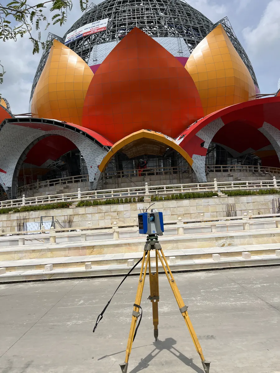
The Z+F IMAGER 5016 in front of Liên Hoa Bảo Tháp during the 2024 survey, while the steel-framed dome was still under construction. Photo: 3DSCAN
Artistic lighting depends directly on form: every lotus petal and relief edge determines where luminaires go and how they are aimed. Meanwhile the site was continuously extended and modified; the drawings no longer matched the as-built condition, and tape measurement is practically impossible on free-form curved surfaces.
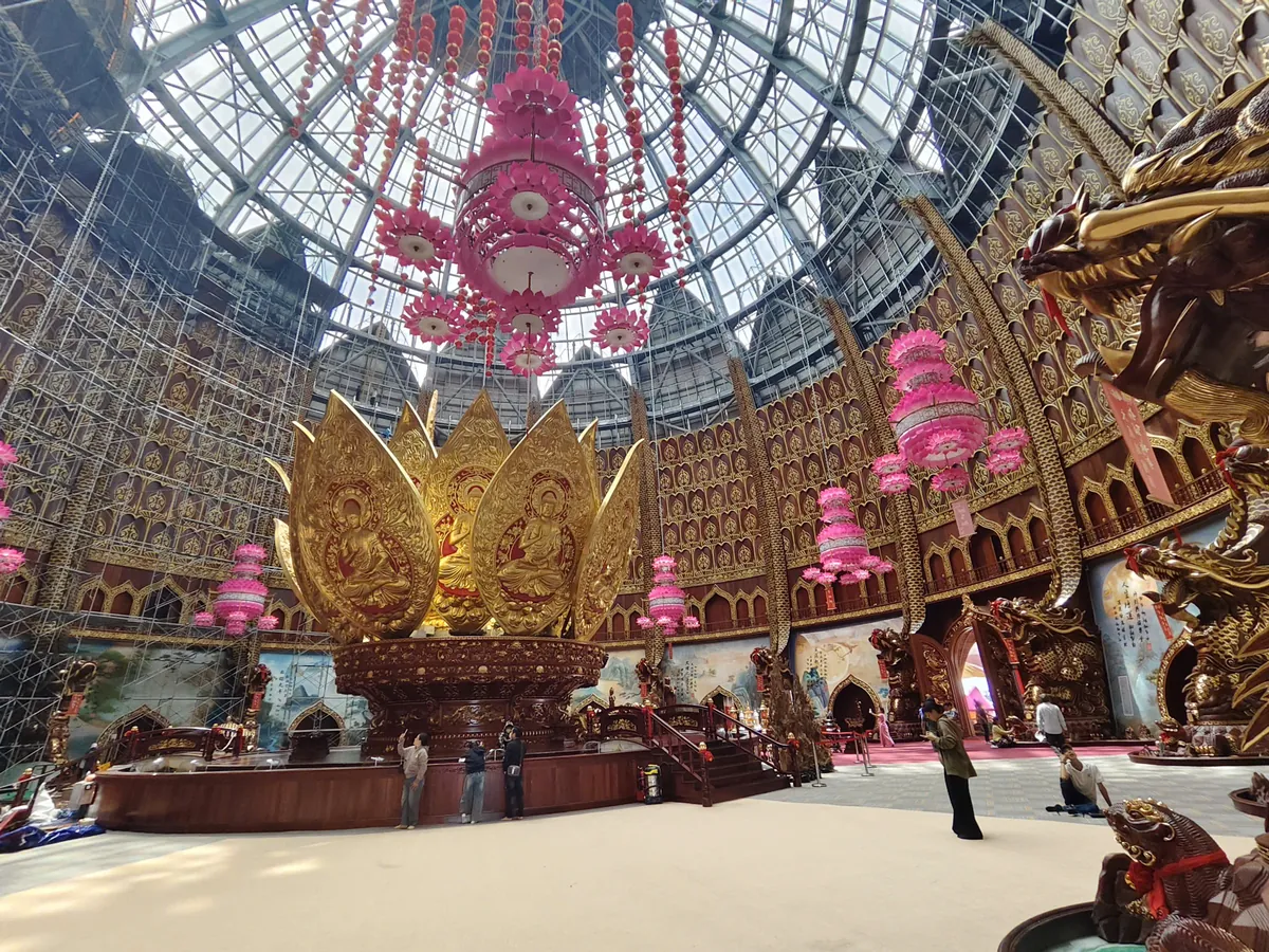
Inside Liên Hoa Bảo Tháp: the golden lotus shrine, reliefs and lanterns beneath the dome. Photo: 3DSCAN
2. Two survey campaigns, two equipment sets
Phase 1 – April 2024: baseline data for the lighting concept
3DSCAN used a Z+F IMAGER 5016 terrestrial laser scanner together with a DJI Phantom 4 RTK UAV for aerial imagery to capture the architectural massing and landscape, producing a baseline 3D model for the design team. Details are available in the Tân Huê Viên 3D modelling project.
Phase 2 – August 2026: updating new areas and modified elements
More than two years later, many areas had been added or altered and the 2024 model no longer held enough detail. 3DSCAN returned to survey and update the 3D model only for the new or modified areas.
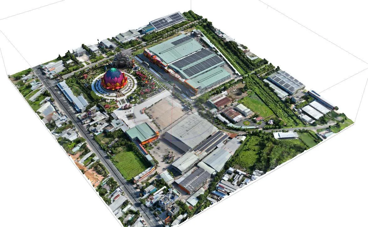
Site-wide 3D model of Tân Huê Viên built from UAV imagery.
The right technology for each area
Equipment used in the 08/2026 update
| Equipment | Area of use | Key specifications (manufacturer) |
|---|---|---|
| DJI Mavic 3E | Roofs, building massing and outdoor landscape over large areas | 20 MP camera, mechanical shutter, RTK support |
| ComNav LS600 (SLAM) | Indoor spaces and routes requiring continuous movement | SLAM LiDAR with RTK, up to 640,000 points per second |
| Leica RTC360 | Statues, reliefs and elements requiring dense, stable data | Up to 2,000,000 points per second; 3D point accuracy 1.9 mm at 10 m (Leica Geosystems datasheet) |
Instrument specifications as published by the manufacturers; they are not the accuracy of the delivered model.
3. Data capture on site
Tân Huê Viên contains many artistic elements: Buddha statues, reliefs, rockeries and entrance gates. The UAV covered the roofs and landscape; an engineer walked the indoor routes with the SLAM scanner; the Leica RTC360 was set up around complex elements. As early as 2024, scan stations were placed right next to the Buddha statues beneath the steel-framed dome, which was still under construction. Occluded zones were checked on site and rescanned – a routine practice in 3DSCAN's heritage conservation surveys.
4. From raw data to a 3D model for the design team
Data from the three sources goes through five steps following 3DSCAN's 3D modelling workflow with UAV and laser scanning.
- Registration: scan stations, SLAM routes and UAV imagery are brought into one common coordinate system.
- Cleaning and reconstruction: noise is removed, then the point cloud and 3D mesh are exported.
- Delivery: data is handed over to GENERAL E&C for lighting studies.
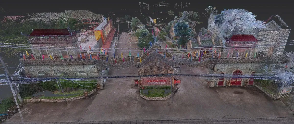
Colour point cloud of the entrance gate area, including flags and overhead cables.
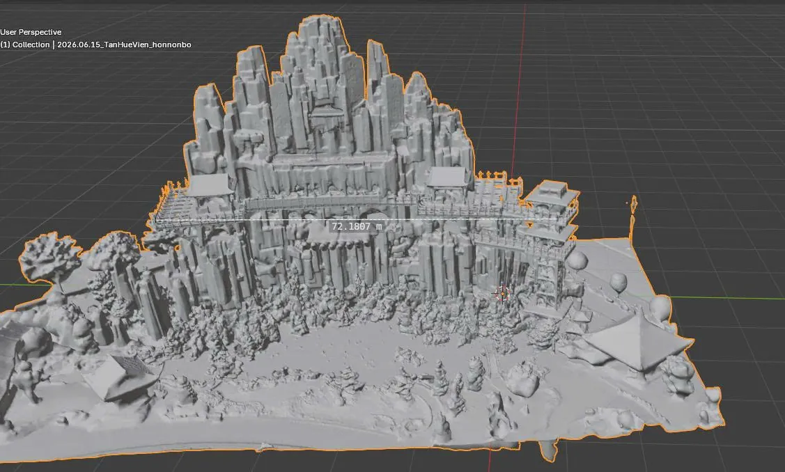
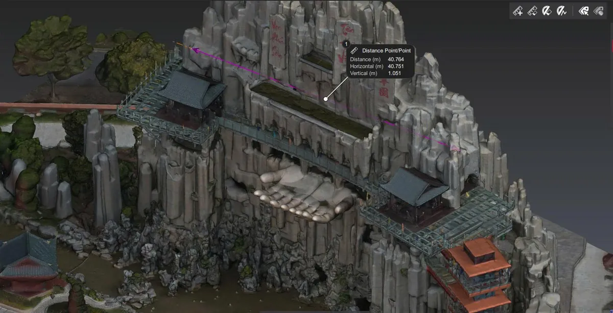
Rockery: mesh model and direct measurement on the textured model (72.18 m; 40.76 m).
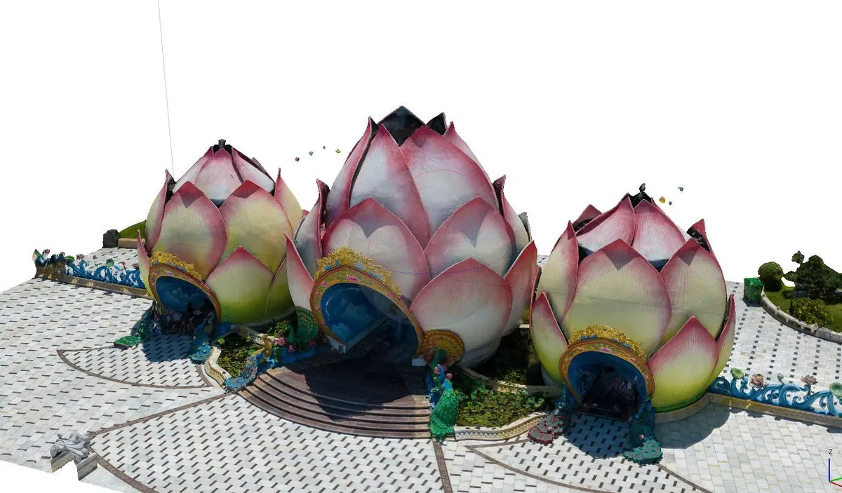
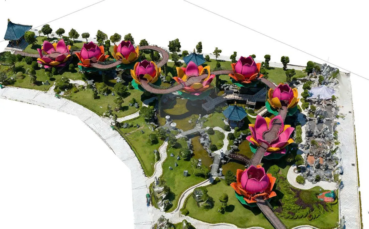
Textured 3D models of the lotus pavilions and lotus walkways on the grounds.
Data quality control
The data is checked for overlap and fit between scan stations and between SLAM and static scanner data; coverage gaps are rescanned, because surfaces not visible on site will not appear in the model.
5. Clear roles: 3DSCAN provides the geometry, GENERAL E&C creates the light
GENERAL E&C is the consultant, designer, equipment supplier and installation contractor for the artistic lighting system at Tân Huê Viên, according to the partner's 2025 year-end review and reporting by Tuổi Trẻ.
3DSCAN is responsible for surveying, digitising and updating the existing-condition 3D model. The model shows the design team the forms and surfaces to be lit so they can study luminaire positions and aiming; the final lighting effect is determined by the lighting contractor's simulation software and engineering calculations. Where objects with attributes are needed, a Scan to BIM workflow is delivered separately.
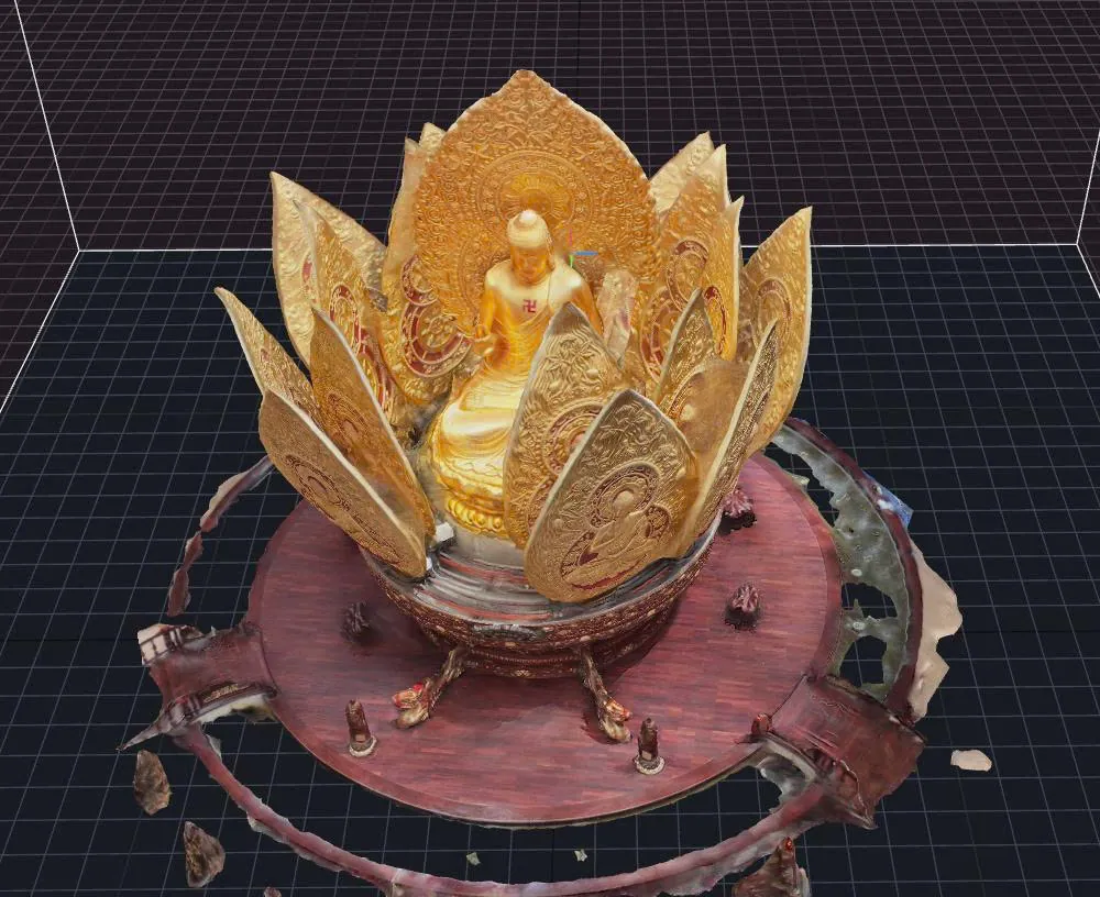

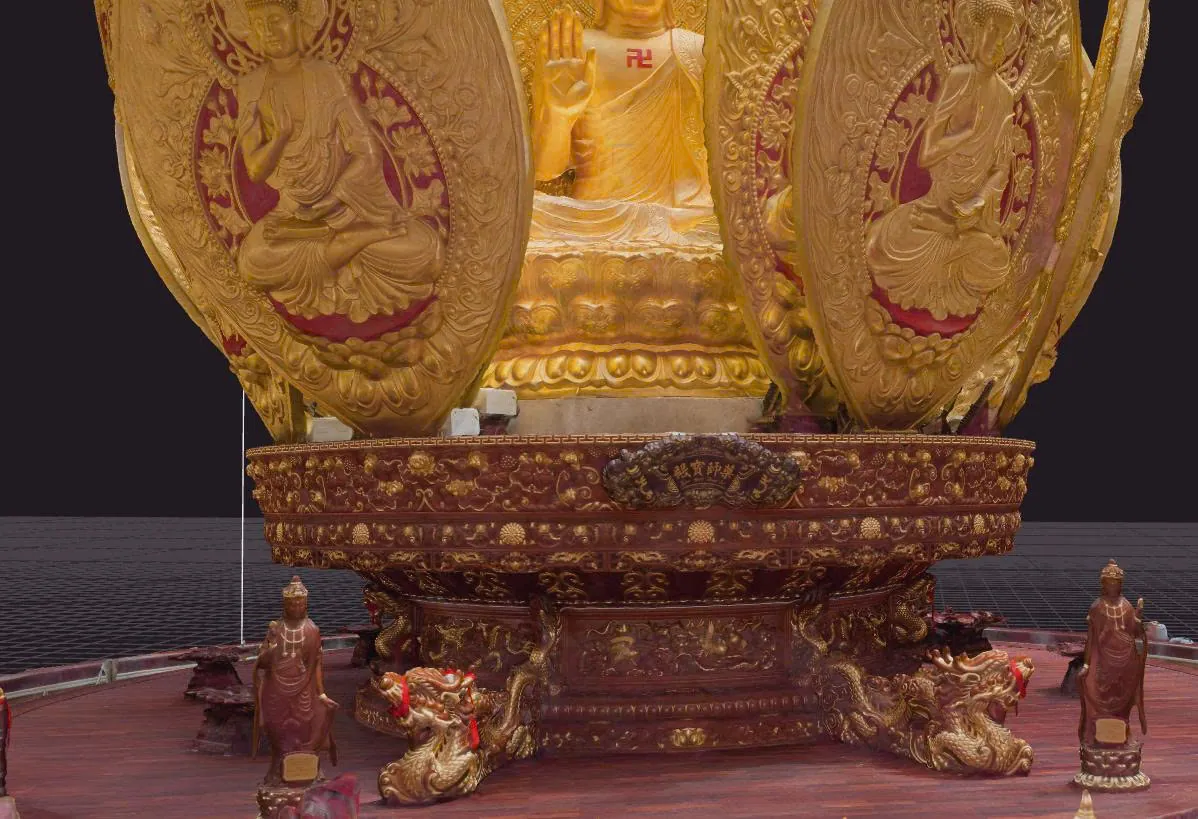
3D models of the golden lotus shrine, Buddha statue and dragon-carved pedestal.
“On surfaces like lotus petals or reliefs, measuring with a tape and rebuilding from drawings is both slow and prone to deviating from reality. Rescanning only what has changed and updating the model keeps the design team working on the latest as-built condition.”
— Phan Tiên Duyên, Director, 3DSCAN Technology Company Limited
6. Lessons learned: a 3D model must be updatable
Across two campaigns more than two years apart, 3DSCAN found that the greatest value of an existing-condition 3D model lies not in its first creation but in its ability to be updated throughout the life of the building. Specifically:
- Local updates: only new or modified areas are surveyed, without rebuilding the entire model.
- Multi-technology integration: UAV, SLAM and TLS compensate for each other's limitations on the same site.
- Less manual modelling: free-form surfaces come directly from measured data.
7. Conclusion
The Tân Huê Viên project shows how 3DSCAN combines UAV, SLAM and 3D laser scanning to turn complex as-built architecture into updatable design data. Headquartered in Ho Chi Minh City, 3DSCAN carries out surveying and digitisation projects across many provinces.
Related projects by 3DSCAN
- Tân Huê Viên 3D model – 2024 phase — initial baseline data captured with Z+F and UAV.
- 3D laser scanning of Hanoi's St. Joseph's Cathedral — digitising highly detailed architecture.
- 3D laser scanning for the conservation of Xá Lợi Pagoda — Buddhist architecture in Ho Chi Minh City.
- 3D topographic surveying by UAV — spatial data over large areas.
Need an existing-condition 3D model for architectural, landscape or lighting design? Contact 3DSCAN to discuss the survey scope and the right combination of UAV, SLAM and laser scanning for your project.
Contact 3DSCAN Hotline: 0938 309 808 · Email: lienhe@3dscan.vn