In the era of digital transformation within the construction and infrastructure sectors, UAV surveying (unmanned aerial vehicle surveying) has become an advanced solution that enables fast, accurate, and safe data collection. Thanks to flexible flight capabilities, high-resolution imaging, and aerial 3D scanning, UAV technology provides a comprehensive perspective for measurement, mapping, inspection, and construction progress monitoring. This breakthrough helps optimize project costs and significantly enhances efficiency in modern engineering workflows. Let’s explore more with 3DScan in the article below.
How Does a UAV Capture Survey Data?
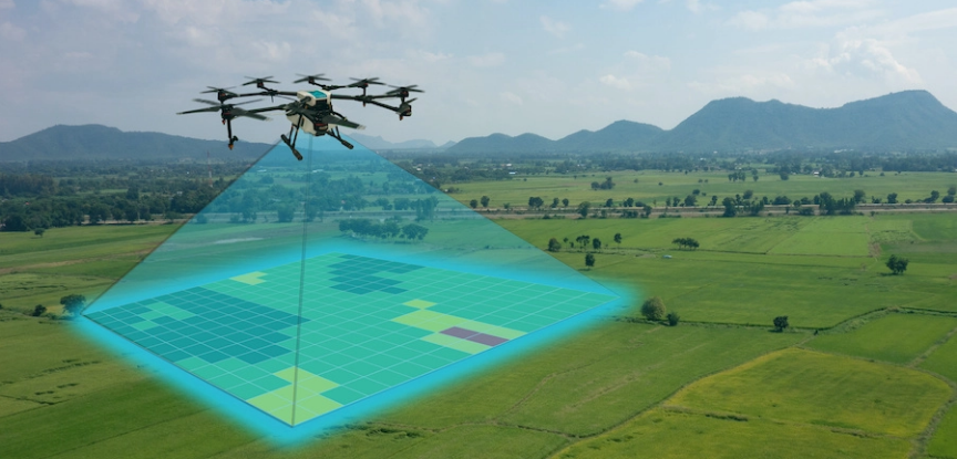
During a UAV survey, the unmanned aircraft functions as an “aerial eye,” capturing real-world spatial data without requiring surveyors to physically traverse the terrain. The technology operates through a closed workflow—from flight planning to 3D model generation—with key steps including:
- Flight planning: Engineers determine the survey area, flight altitude, speed, and image overlap to ensure full coverage.
- Data acquisition & GPS positioning: During flight, the UAV uses GNSS/GPS and IMU sensors to precisely geotag every captured image.
- Image capture & point cloud scanning: Depending on project needs, UAVs can acquire high-resolution images or LiDAR point clouds to build detailed 3D terrain and structural models.
- Processing & 3D reconstruction: Data is processed using software such as Pix4D, Agisoft Metashape, or DJI Terra to create 3D models, DSM/DTM terrain maps, and centimetre-accurate orthophotos.
Thanks to this workflow, UAVs can survey tens of hectares in just a few hours, delivering fast, accurate, and highly visual data for design, monitoring, and infrastructure management.
Why UAV Surveying Outperforms Ground-Based Methods
Compared with traditional surveying methods, UAV surveying offers significant advantages in speed, accuracy, and terrain coverage. Instead of manually measuring point by point, the UAV collects comprehensive data from above—even in difficult or hazardous areas.
Key advantages of UAVs over ground instruments include:
- Outstanding speed: UAVs can cover tens of hectares within hours—far faster than manual survey teams.
- High accuracy: GPS-IMU positioning ensures centimetre-level precision suitable for construction and infrastructure projects.
- Wide coverage: UAVs fly at flexible altitudes, accessing steep slopes, forests, and obstacles with ease.
- Reduced cost & manpower: Only 1–2 technicians are required—minimizing labour and deployment costs.
- Improved safety: Eliminates the need to access dangerous terrains such as steep cliffs, high structures, or active construction zones.
These advantages make UAVs the next-generation surveying tool, helping businesses improve productivity, reduce costs, and stay in control of project data.
See more: 3D laser scanning technology improves accuracy and reduces project cost
3D Modeling Workflow Using UAV Data at 3DScan.vn
At 3DScan, the entire UAV surveying workflow is executed end-to-end—from inspection, flight execution, and data processing to final deliverables. This ensures high accuracy (error < 3 cm) and fast turnaround, meeting strict requirements in construction, planning, and infrastructure projects.
Step 1 – Consultation & Requirement Analysis
- Collect project information, survey objectives, area, and technical specifications.
- Recommend suitable UAV types, software, and output formats (2D/3D/Orthophoto/DEM).
Step 2 – Flight Planning
- Configure RTK flight paths, altitude, and image overlap (70–80%).
- Set up GCPs, base stations, or CORS connections for accurate georeferencing.
- Check weather, airspace, and on-site safety conditions.
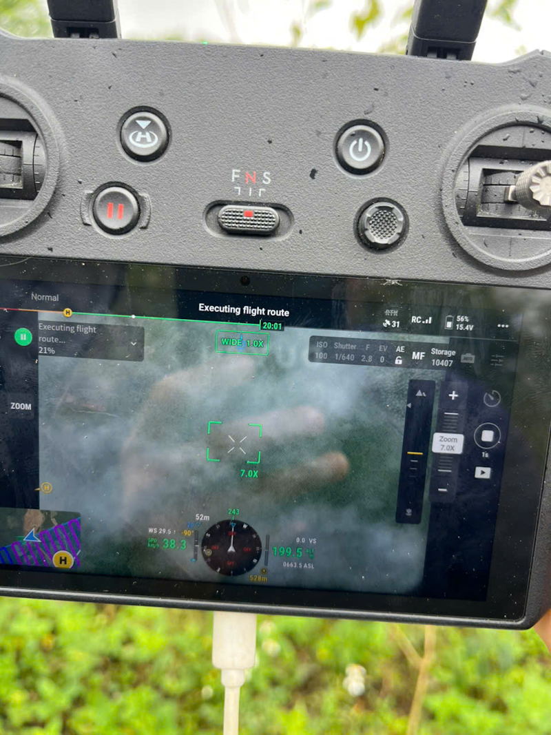
Step 3 – Field Data Acquisition
- Capture high-resolution RTK imagery across the survey area.
- Ensure uniform coverage, sharp images, and visible control points.
- Record synchronized GPS/RTK data for streamlined processing.
Step 4 – Data Processing & 3D Reconstruction
- Process imagery using Metashape, Pix4D, or ContextCapture.
- Generate deliverables:
- Orthophoto
- DEM/DTM
- Point cloud (LAS, E57)
- 3D mesh model
- Validate accuracy using GCPs to ensure error < 3 cm.
Step 5 – Deliverables
- Provide industry-standard formats:
- 2D: DWG, DXF, GeoTIFF
- 3D: OBJ, FBX, E57
- Deliver technical reports and an online viewer for easy measurement and sharing.
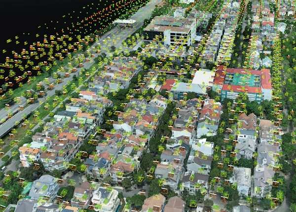
Implementation Time
Depending on area and complexity, most UAV survey projects are completed within 2–7 days with fast delivery and high-quality data.
Value of UAV Survey Data for Engineers and Investors
Beyond capturing images and 3D models, UAV survey data provides significant practical value for engineers, designers, and project owners. It enables accurate understanding of site conditions, progress tracking, and data-driven decision-making.
Key applications include:
- Design & technical drawings: 3D models and DSM/DTM maps serve as accurate foundations for infrastructure and site design.
- Progress monitoring: Regular UAV flights compare site conditions with design drawings.
- Cut & fill volume calculation: Detailed terrain data ensures precise earthwork estimations.
- Deformation detection: UAVs reveal subtle terrain or structural changes that ground surveys may miss.
- BIM/GIS integration: UAV data easily integrates with BIM models and GIS platforms for full lifecycle project management.
This makes UAVs not only a surveying tool but also a strategic data platform for fast, accurate, and efficient project decision-making.
See more: Businesses advance digital transformation with 3D surveying technology
Comparison: UAV 3D Terrain Survey vs. Traditional 2D Topographic Maps
Real-World UAV Surveying Applications
UAV surveying is not only fast and accurate but also highly versatile across various fields. From large-scale developments to complex infrastructure, UAVs deliver quick, visual, and reliable data for engineers and investors.
Typical applications include:
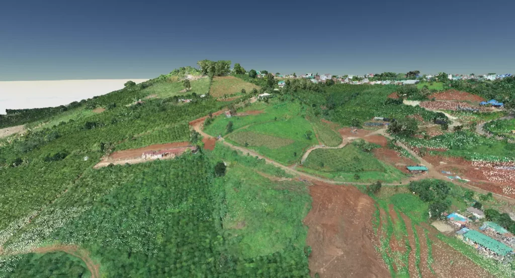
- Large-scale terrain surveying for master planning, grading, and 3D mapping.
- Construction progress monitoring through periodic aerial updates.
- Bridge & road infrastructure inspections without disrupting traffic.
- Renewable energy projects (wind farms, solar farms) for siting and maintenance.
- Urban planning & smart city management with 3D UAV modeling.
With its flexibility and efficiency, UAV surveying is becoming indispensable in modern project management, especially where speed and accuracy are critical.
Conclusion
It is evident that UAV surveying is not just a technological advancement but a transformation in how modern projects approach surveying and data management. Thanks to its speed, accuracy, and highly visual outputs, UAVs empower engineers, contractors, and investors to make informed decisions, reduce errors, and optimize costs.
The adoption of UAV technology has become a strategic advantage in the construction and infrastructure sectors. In this era of digital transformation, UAV data integrates seamlessly with 3D models, BIM, and GIS, delivering real value across the entire project lifecycle. Contact 3DScan for tailored solutions and detailed quotations for your project!