


3D Laser Scanning at INSEE Hon Chong Cement Plant – Periodic Stockpile Survey and Storage Tank Volume Calculation
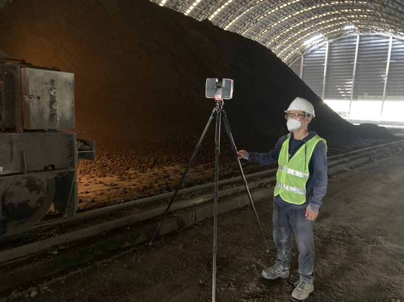
3DScan.vn carried out a 3D laser scanning project to support periodic stockpile and inventory calculations at the INSEE Hon Chong Cement Plant (Kien Giang province), covering a total survey area of 120 ha. The project combined two modern survey technologies: Faro Focus S120 for detailed indoor laser scanning and silo/tank measurement, and UAV Phantom 4 RTK for outdoor surveys, in order to evaluate volume, material stockpiles and on-site inventory with high accuracy, supporting the plant’s periodic inventory and production management.
Contact us for 3D laser scanning industrial stockpile surveys
 1. Project objectives and scope
The project focused on measuring – calculating – validating on-site stockpile volumes for cement silos, raw stone stockpiles and quarry/transport areas across the entire INSEE Hon Chong plant (120 ha). By applying 3D Laser Scanning combined with UAV RTK, the team accurately determined material volumes, height differences and terrain changes over time, supporting periodic inventory and technical reporting.
- Location: INSEE Hon Chong Cement Plant, Kien Luong district, Kien Giang province.
- Survey scope: 120 ha including clinker yards, cement stockpiles, limestone areas and closed silo/tank systems.
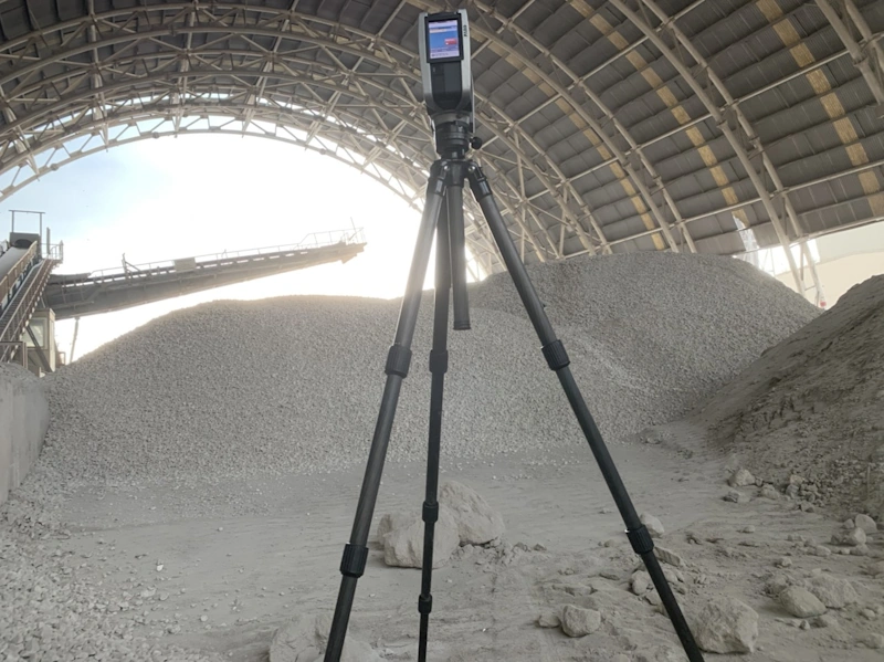
- Equipment used: Faro Focus S120 (indoor 3D laser scanning, accuracy ±2 mm); UAV Phantom 4 RTK (outdoor photogrammetry, accuracy ±3 cm).
- Main objective: Determine remaining material volumes, track stockpile changes and update 3D terrain models on a periodic basis.
- Deliverables: 3D point cloud, terrain models (DSM/DTM), orthophoto maps and volumetric stockpile reports.
 2. Technical workflow
The project was implemented by combining two advanced survey methods – terrestrial laser scanning (TLS) and UAV aerial photogrammetry – ensuring complete data capture for both enclosed spaces and open areas, all unified in the VN-2000 coordinate system.
a) 3D laser scanning with Faro Focus S120
- Detailed scanning of the entire cement silo and storage tank system using hundreds of linked scan stations.
- Station registration via target-based registration to ensure point errors < 3 mm.
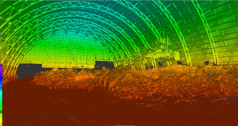
- Extraction of a 3D model of the internal surfaces of storage tanks and silos to calculate in-place material volumes.
b) Outdoor UAV Phantom 4 RTK flight campaign
- Flown at 60–120 m altitude with 80/70% overlap to capture imagery across the entire 120 ha site.
- Coordinate adjustment using GNSS-measured GCPs, achieving spatial accuracy of ±3 cm.
- Image processing in photogrammetry software (Pix4D/Metashape) to generate detailed terrain models and orthophoto maps.
c) Stockpile analysis and volume calculation
- Merging UAV and laser scan data to create a unified site-wide 3D model.
- Classifying materials (clinker, cement, limestone) using surface analysis and solid modelling.
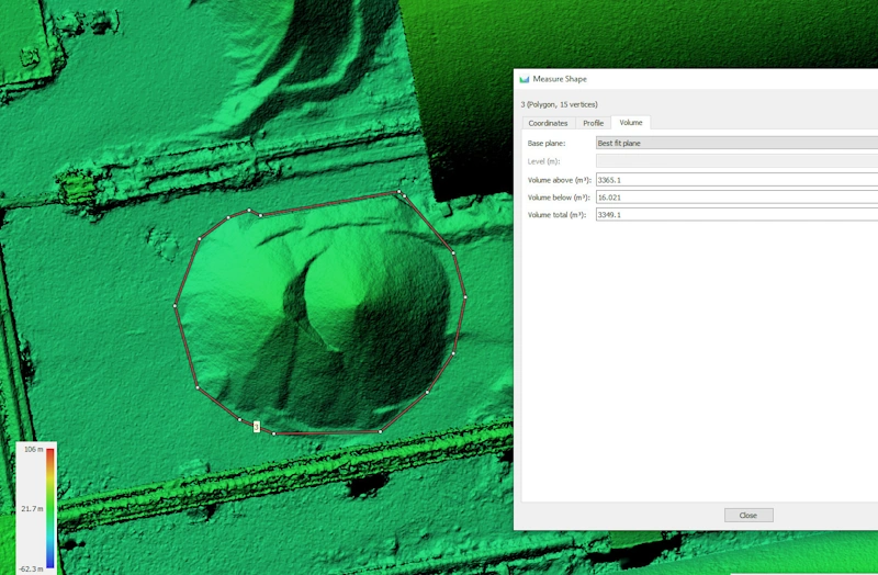
- Calculating volumes for each stockpile, storage tank and material bunker using 3D surface and cross-section methods.
- Preparing periodic volumetric stockpile reports showing remaining material volumes, changes versus previous periods and clear comparison charts.
 3. Results and applications
The project provided INSEE Hon Chong with a fully digitised dataset of the entire production and storage area, supporting accurate stockpile volume calculations and periodic material change monitoring on a quarterly/annual basis. All data is aligned in the VN-2000 coordinate system and can be published online via a 3D web viewer platform.
- Orthophoto map: high-resolution imagery accurately reflecting current conditions across the 120 ha site.
- 3D volume model: geometrically accurate representation of storage tanks, stockpiles and elevation differences.
- Technical report: including volume tables, comparison charts, measurement accuracy and time-series variation reports.
- Data applications: supporting inventory, financial reporting, operational planning and storage yard expansion studies.
Conclusion
The 3D Laser Scanning – INSEE Hon Chong project demonstrates the outstanding effectiveness of 3D scanning technology in industrial stockpile and volume management. The combination of Faro S120 and UAV Phantom 4 RTK enables high-accuracy data capture under all conditions – from inside closed storage silos to large outdoor stockyards. The resulting volume accuracy better than < 1.5% allows INSEE to take control of inventory, production monitoring and periodic reporting.
Need to survey material stockpiles, storage tank volumes or quarry areas with high accuracy? 3DScan.vn delivers a complete solution with 3D Laser Scanning – UAV RTK – Professional volumetric reporting, meeting industry technical standards and large-scale management requirements.
Contact 3DScan.vn Hotline: 0938309808 · Email: lienhe@3dscan.vn



